Lots of rain in forecast this week

National Weather Service graphic

Morning storms are moving through an area east of the Kansas City metropolitan area this morning.

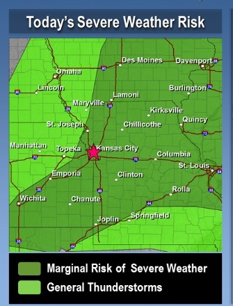
Another round of storms is possible late this afternoon into the evening, and could be strong to marginally severe, according to the National Weather Service.

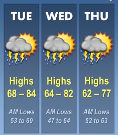
Several additional rounds of storms are possible Wednesday and Thursday, with the potential for severe weather each day, the weather service said.

Friday and Saturday could be sunny and clear, with thunderstorms possible again Saturday night through Monday.

The chance of precipitation is about 20 percent today, the weather service said. The high will be near 82.

Tonight, there is a 30 percent chance of showers and thunderstorms, mainly before 1 a.m., according to the weather service. The low will be around 56. New rainfall amounts will be less than a tenth of an inch, the weather service said.

On Wednesday, showers and thunderstorms are likely, mainly after 1 p.m., according to the weather service. The chance of rain is 60 percent. The high will be near 78. An east wind of 8 to 14 mph will change to south in the afternoon, and winds could gust as high as 20 mph, the weather service said.

A quarter to a half-inch of rain is possible, according to the weather service.

On Wednesday night, showers and thunderstorms are likely, with a low around 62, the weather service said. The south wind of 14 to 16 mph, may gust as high as 23 mph.

Thursday, there will be a 30 percent chance of showers and thunderstorms, according to the weather service. The high will be near 71, with a south southwest wind of 14 to 17 mph becoming west in the afternoon, and possibly gusting up to 20 mph.

Thursday night, the low will be near 42, the weather service said.

Friday’s forecast is sunny, with a high near 65, and Saturday, mostly sunny with a high near 68, according to the weather service.

Saturday night, there is a 40 percent chance of precipitation, with a low around 52, the weather service said.

Sunday, the chance of showers and thunderstorms is 60 percent, according to the weather service. The high will be near 70.
National Weather Service graphic

Forecast calls for cloudy skies, drizzle in morning

Weather today. (National Weather Service graphic)

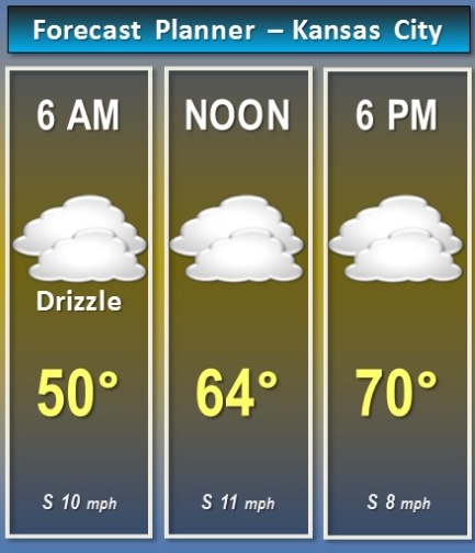
Today’s forecast calls for cloudy skies today, with periods of drizzle in the morning, according to the National Weather Service.

The temperature was 52 degrees at 8 a.m. Today, a south wind of 11 to 13 is in the forecast, the weather service said.

Much of the afternoon will be rain-free, with temperatures gradually warming into the 60s to lower 70s, according to the weather service.

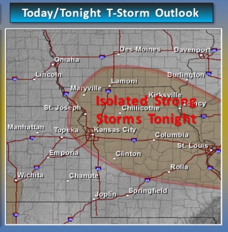
By tonight, a few isolated thunderstorms may develop, the weather service said. They are predicted for after 10 p.m., the weather service said.

A couple of these storms could be strong, but the overall severe weather threat remains low tonight, according to the weather service.

A better chance for thunderstorms is expected Wednesday evening and overnight, when severe weather is possible for much of the area, the weather service said.

Storm are possible from today through Thursday, according to the weather service. There are no freezing temperatures predicted this week.

For more weather information, visit www.weather.gov.

Thunderstorm outlook. (National Weather Service graphic)

Cooler weather today, sunny and clear for weekend

Weekend weather. (National Weather Service graphic)

After rain showers moved through this morning, cool weather is in store for the rest of the day, with a high around 54, according to the National Weather Service.

While the skies will gradually clear today, it will remain cool today, with temperatures rebounding for the rest of the weekend, the weather service said.

A north wind today will be 17 mph, gusting as high as 26 mph, according to the weather service.

Tonight’s low will be around 33, the weather service said. Winds will be north northwest 10 to 15 mph with gusts as high as 22 mph.

Clear and sunny weather is expected Saturday and Sunday, according to the weather service.

It will be sunny with a high near 64 Saturday, with a low of 43 Saturday night, the weather service said.

Easter Sunday, it will be mostly sunny, with a high near 66, the weather service said. Sunday night’s low will be around 49.

Monday, a 30 percent chance of rain and thunderstorms returns after 8 a.m., with a high of 72, according to the weather service. Monday night, the low will be around 58 with a 50 percent chance of rain.