Snow showers are possible, mainly after 11 a.m. on Sunday, according to the National Weather Service.
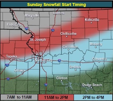
A light snow will develop around sunrise in the northern part of the state, and snow will then move east and southeast, the weather service said. The snow may fall in the Kansas City area mostly between 2 p.m. and 4 p.m., according to forecasters.
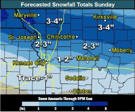
The high will be near 32 on Sunday with a northeast wind of 11 mph. The chance of snow is 80 percent. New snow accumulation of less than one inch is expected in Wyandotte County, the weather service said.
Sunday night, snow showers are likely before 7 p.m., according to the weather service. The low will be around 25, with an east northeast wind of 3 to 8 mph. Less than a half-inch of new snow accumulation is likely.
Monday, there is a 20 percent chance of freezing rain before 11 a.m., then a slight chance of rain, according to the weather service. The high will be near 44 with an east southeast wind of 6 to 10 mph.