Snow falling

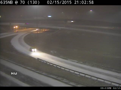
Snow has been falling in Wyandotte County since a little before 9 p.m. Sunday. This view shows snow at I-70 and I-635. (KC Scout photo)

At 10 p.m., a National Weather Service forecast called for two to four inches of snow for the Wyandotte County area tonight.

Bands of snow will continue across the area into the pre-dawn hours before tapering off for the morning commute to work, the weather service said.

Roads will remain snow and ice-covered and slippery, the weather service said.

Residents should be prepared for slippery roads and limited visibility and use caution while driving, the weather service said.

For more weather updates, visit www.weather.gov.
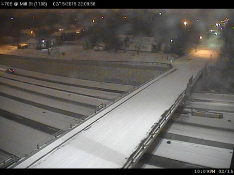
I-70 and Mill Street in Kansas City, Kan., on Sunday night. (KC Scout photo)

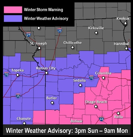
Winter weather advisory in effect this afternoon until Monday morning

Winter weather advisory (National Weather Service graphic)

The weather forecast from the National Weather Service now calls for a winter weather advisory in effect from 3 p.m. Feb. 15 until 9 a.m. Feb. 16.

There is the possibility of a storm system moving into the area this evening with snow developing late and overnight, the weather service said.

Snow may develop along the I-70 corridor and spread southweard dthrough the late afternoon into the evening hours, according to the weather service.

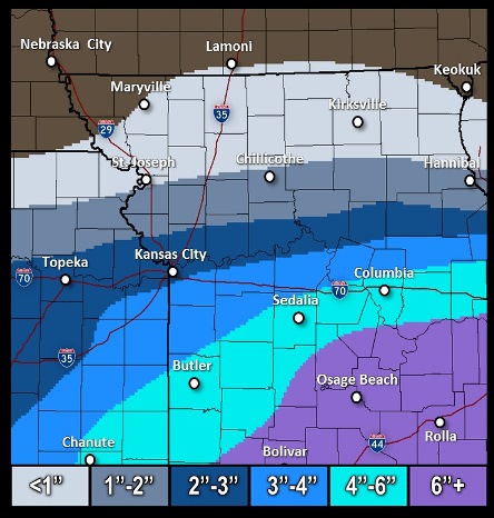
Snow amounts could range from 3 to 6 inches in the central part of the state, south of the Kansas City area, while in the Kansas City area, 1 to 3 inches of snow may be possible, according to the weather service.

The weather service said residents should be prepared for slipper roads and limited visibilities and use caution while driving.

For more information, see www.weather.gov.

Snow accumulation (National Weather Service graphic)

Slight chance of snow possible Sunday

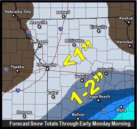
National Weather Service graphic

Light snow is possible on Sunday, as a clipper system is moving in from the northwest, according to the National Weather Service.

There is a 20 percent chance of snow on Sunday, starting around 9 a.m., according to the weather service. The high will be near 20.

Tonight, there is a dangerously cold wind chill across the area, according to the weather service. The wind chill index will be between -8 and 2.

Any snow on Sunday probably will be less than one inch in total, the weather service said.

For Monday, Washington’s birthday, expect a high near 33 degrees, according to the weather service.

Tuesday, the high will be near 31, and Wednesday, near 22, the weather service said.