Storms moved through Wyandotte County this morning, leaving about a quarter-inch of rain behind.
There is a slight chance of rain this afternoon, according to the National Weather Service forecast.
The rain will end by tonight, the weather service said.
Tonight, it will be mostly cloudy with a low around 47, the weather service said.
Sunday, expect partly sunny skies with a high near 61, the weather service said. An east wind will be from 11 to 16 mph, with gusts up to 24 mph on Sunday.
Sunday night, it will be partly cloudy, with a low around 43, according to the weather service. An east northeast wind of 8 to 15 mph, will gust as high as 21 mph.
National Weather Service graphic
The National Weather Service said that the storm system moving into the region has slowed down and is not expected to move into the local area until late this evening and overnight.
This has shifted the highest threat for strong to severe storms westward, according to the weather service.
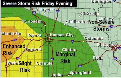
Wyandotte County is in a marginal risk area.
Weakening thunderstorms moving in from the west will spread into these areas between 6 p.m. and midnight, the weather service said. The main threats will be large hail 1 inch or greater and locally damaging winds to 60 mph. They may be scattered only.
Locally heavy rainfall and minor flooding is also possible especially north of I-70, according to the weather service.
Storms will continue to weaken when they reach these marginal risk areas between 8 p.m. and 5 a.m. There could be isolated instances of hail near 1 inch or winds of 55 to 60 mph, but the overall severe threat is low, the weather service said.
For more weather updates, visit www.weather.gov. National Weather Service graphic
Severe storm risk (National Weather Service graphic)
Isolated strong to severe thunderstorms are possible on Friday, according to the National Weather Service.
Rain was falling about 8 a.m. in parts of Wyandotte County. There is a chance of showers and possibly a thunderstorm between 9 a.m. and 11 a.m., the weather service said.
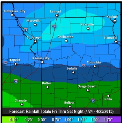
The chance of showers and thunderstorms continues after 11 a.m., the weather service said. The chance of precipitation is 60 percent, and a south-southeast wind from 10 to 15 mph is expected, with gusts as high as 22 mph. There could be a tenth to a quarter of an inch of rain possible.
Tonight, there is a 90 percent chance of showers and thunderstorms, mainly before 1 a.m., the weather service said. A south southeast wind of 13 to 15 mph may gust as high as 21 mph. There could be between a half to three-quarters of an inch of rain.
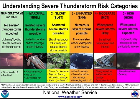
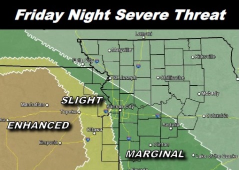
Wyandotte County is in the “marginal” risk category for severe storms, according to a weather service graphic, which means isolated severe thunderstorms are possible.
The weather service anticipates the strongest storms will be west of a line from Falls City, Neb., to Sedalia, Mo., which includes Wyandotte County. Some isolated flooding may be possible along and north of Highway 36, around the St. Joseph, Mo., area, because of heavy rain, according to the weather service.
On Saturday, expect showers and thunderstorms before 1 p.m. The chance of rain is 30 percent, and it will be windy, with a south southwest wind of 13 to 18 mph becoming northwest in the afternoon, and winds gusting as high as 28 mph.
To keep up to date on the weather today, visit www.weather.gov. Rainfall forecasts (National Weather Service graphic)