Racing was under a red flag on lap 98 of the 267-lap Sprint Cup series race tonight at the Kansas Speedway, as rain fell and lightning was seen.
Radar maps from the National Weather Service showed that Kansas City, Kan., was receiving the weak part of a line of storms that stretched from Nebraska to Springfield, Mo.
Drivers were waiting as the race needed 36 more laps to be official.
National Weather Service graphic
Scattered thunderstorms will pop-up across the region this afternoon, according to the National Weather Service.
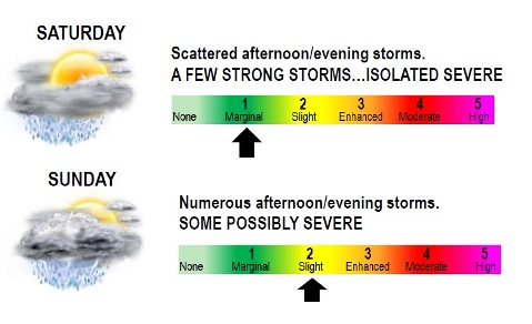
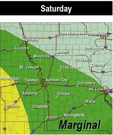
A few storms could become strong with small hail, gusty winds, and dangerous lightning being the primary hazards, the weather service said. An isolated severe storm or two cannot be ruled out.
There is a 50 percent chance of rain and storms this afternoon, and the risk increases to 60 percent later tonight, according to the weather service. Some forecasters are saying that there is very little chance of severe weather today; however, lightning could be a threat. There also is a good chance of lightning missing Wyandotte County tonight.
Today’s high was predicted near 75, with an east wind around 11 mph, the weather service said. Tonight’s low was expected to be 65 degrees, with a southeast wind of 14 to 18 mph, gusting to 28 mph, according to the weather service.
Additional storms are expected Sunday, according to the weather service.
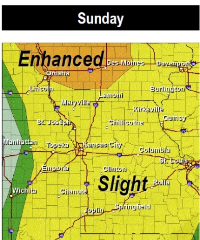
The threat on Sunday will be conditional on whether the airmass can recover from morning storms and become unstable. If it does, severe storms with large hail and damaging winds will be the primary threats, according to the weather service.
For current weather information, visit www.weather.gov. Saturday thunderstorm risk (National Weather Service graphic) Sunday severe thunderstorm forecast (National Weather Service graphic)
National Weather Service graphic
After this morning’s thunderstorms and rain, there could be a period of comparatively dry weather until this evening, when the chance of thunderstorms increases again, according to the National Weather Service.
Today’s high will be about 72 degrees. Severe thunderstorms and heavy rain are not expected for the rest of the day, and today’s forecast says a 30 percent chance of rain.
There is a 60 percent chance of showers and thunderstorms tonight, mainly after 10 p.m., the weather service said. Tonight’s low will be 61.
A few thunderstorms will likely develop Saturday afternoon especially for areas near and southwest of the Kansas City metro area, according to the weather service. There is a 50 percent chance of rain Saturday.
A few of these storms on Saturday could be severe with large hail and damaging winds, the weather service said.
Saturday’s high will be near 77. Saturday night’s low will be 65, the weather service said, and winds will be 11 to 14 mph, gusting to 20 mph. The chance of precipitation is 60 percent Saturday night.
Another round of storms is expected Sunday, this time across most of the region, the weather service said. These could be a bit more numerous than Saturday’s activity.
Large hail and damaging winds will again be the primary threats in a few of the stronger storms Sunday, the weather service said.
Sunday’s high will be near 78, according to the weather service. A south wind of 14 to 20 mph will gust up to 29 mph. The chance of rain Sunday is 60 percent.
Sunday night, there is a chance of thunderstorms and showers, with a low of 50, the weather service said. The chance of rain is 40 percent.
There’s no rain in the forecast for Monday, which is expected to be mostly sunny with a high of 65.
For more weather information, see www.weather.gov. National Weather Service graphic Severe thunderstorm risk areas on Sunday (National Weather Service graphic) National Weather Service graphic