Wyandotte County is under a severe thunderstorm watch until 11 p.m. Monday, according to the National Weather Service. A flash flood watch also will be in effect.
Surrounding counties also are under the severe thunderstorm watch.
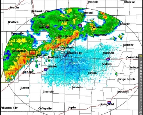
Thunderstorms are expected to develop this afternoon from northwestern Missouri into northeastern Kansas, ahead of an approaching cold front, the weather service said.
These storms will then sink to the southeast from this evening into the overnight period, the weather service said.
Some of the storms may be severe from this afternoon into this evening, with damaging wind gusts of up to 70 mph being the main potential severe weather hazard, according to the weather service. Some storms could produce hail to the size of pennies.
In addition to the potential for severe storms, torrential rainfall and frequent lightning will accompany these storms, the weather service said.
Flash flooding will become an increasing risk from late this afternoon into tonight, especially over areas along and south of a line from Atchison, Kan., to St. Joseph, Mo., to Kirksville, Mo.
For more weather updates, see www.weather.gov.
To see an up-to-date weather radar map, visit http://www.weather.gov/eax/dss.