Light to moderate freezing rain may move into the area Saturday night, according to the National Weather Service.
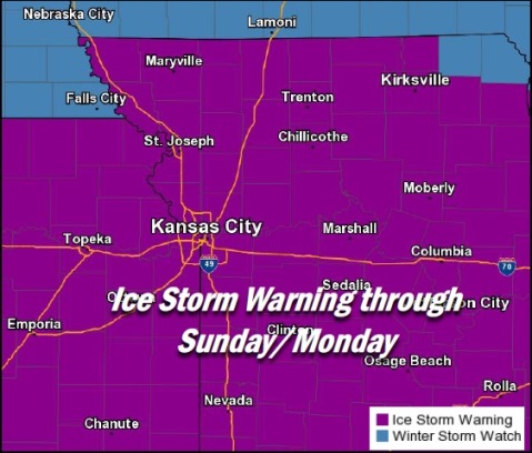
Wyandotte County is under an ice storm warning Saturday through midnight Sunday, the weather service said. Travel is strongly discouraged, according to the weather service.
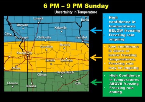
The temperature at 9 p.m. Saturday was 31 degrees. A National Weather Service radar map showed most freezing rain was located south of the Kansas City area at 9 p.m.; however, there was mist in the air.
The weather service said the best icing potential will occur during the overnight periods through Sunday afternoon. Most of the freezing rain may fall after 1 a.m. Sunday.
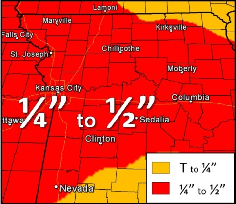
About a quarter to a half-inch of ice is expected across the area, with some locally higher amounts, the weather service said.
Isolated to scattered power outages will be possible, according to the weather service.
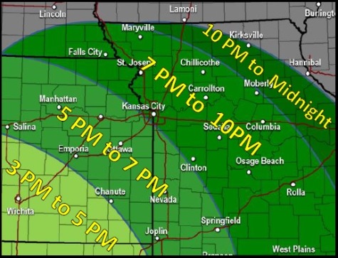
Precipitation will approach from the southwest and gradually lift northeastward beginning Saturday evening, the weather service said.
Freezing rain will lead to rapid ice accumulations through Saturday night, making for treacherous travel conditions through a prolonged period with possible power outages.
On Sunday, the forecast calls for freezing rain before 3 p.m., then rain likely between 3 and 5 p.m. After 5 p.m., freezing rain is likely again, according to the weather service.
Sunday night, more freezing rain is likely before 8 p.m., then rain. The temperature is expected to rise to about 39 by 5 a.m. Monday.
On Monday, the high will be near 51, according to the weather service.