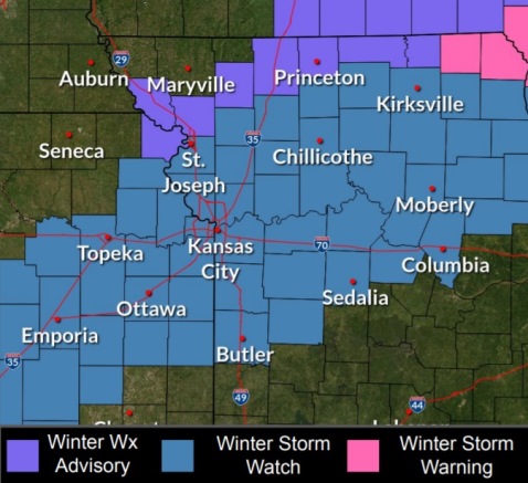

Wyandotte County is under a winter storm watch from 12:01 a.m. Thursday, Feb. 17, through 6 p.m. Feb. 17, according to the National Weather Service forecast.
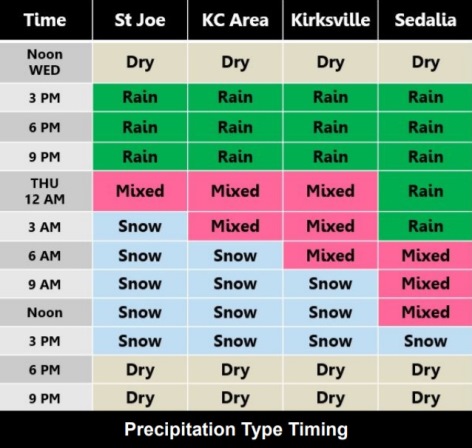
A wintry mix is likely late tonight followed by snow Thursday morning and afternoon, the weather service said.
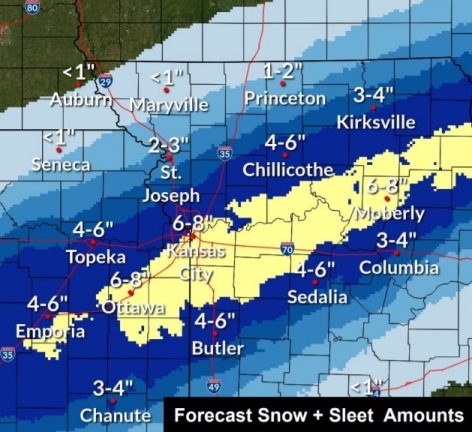
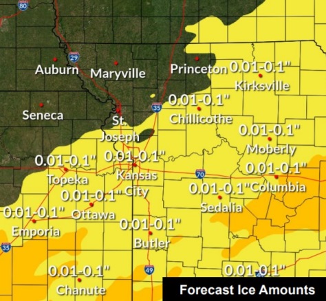
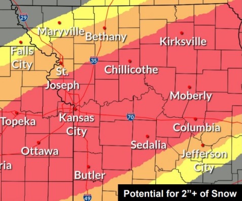
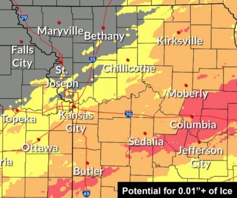
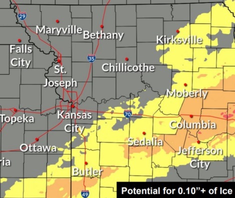
From 4 to 8 inches of snow, and one-tenth of an inch of ice is possible, according to the weather service.
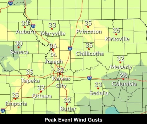
Winds may gust as high as 38 mph today, and as high as 32 mph on Thursday, the weather service said.
Rain with thunderstorms will become likely late this afternoon and evening, according to the weather service.
Cold air moving southward will result in a transition from liquid to a mix of sleet and freezing rain to snow from northwest to southeast with time, the weather service said.
Blowing and drifting snow is likely, with 11 to 18 mph winds and 32 mph gusts possible Thursday, according to the weather service.
Periods of moderate to heavy snow paired with gusty winds on Thursday morning and early afternoon could lead to significantly reduced visibilities and very hazardous travel conditions, the weather service said.
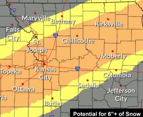
Heaviest snowfall accumulations at this time are expected in a narrow band from the southwestern side of the Kansas City area to Moberly, Missouri, where 8 inches of snow is possible, the weather service said.
For forecast updates, check www.weather.gov.
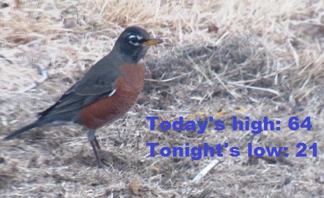
Today, there is a 30 percent chance of rain, mainly after 4 p.m., the weather service said. The high will be near 64 with a south southwest wind of 13 to 20 mph becoming west in the afternoon. Winds may gust as high as 38 mph. Less than a tenth of an inch of rain is possible.
Tonight, there is an 80 percent chance of rain, freezing rain and sleet before 4 a.m., then snow, freezing rain and sleet between 4 a.m. and 5 a.m., then snow and freezing rain after 5 a.m., according to the weather service. Some thunder also is possible. The low will be around 21. A west wind of 11 to 17 mph will become north northeast after midnight. Winds may gust as high as 32 mph. New ice accumulation will be less than one-tenth of an inch possible. New snow and sleet accumulation will be less than a half-inch possible.
Thursday, there is a 90 percent chance of snow, mainly before noon, the weather service said. The snow could be heavy at times. Patchy blowing snow is possible between 7 a.m. and noon. The high will be near 26. A north northwest wind of 11 to 18 mph will gust as high as 32 mph. New snow accumulation of 4 to 8 inches is possible.
Thursday night, it will be mostly clear, with a low of 3, according to the weather service. A north northwest wind of 5 to 7 mph will become calm, with winds gusting as high as 18 mph.
Friday, it will be sunny, with a high near 40, the weather service said. A south southwest wind of 6 to 15 mph will gust as high as 25 mph.
Friday night, it will be mostly clear, with a low of 22, according to the weather service.
Saturday, it will be sunny, with a high near 45, the weather service said.
Saturday night, it will be mostly clear, with a low of 37, according to the weather service.
Sunday, it will be sunny, with a high near 55, the weather service said.
Sunday night, it will be partly cloudy, with a low of 43, according to the weather service.
On Monday, Presidents Day, there is a 30 percent chance of rain, with a high near 60, the weather service said.
Monday night, there is a 40 percent chance of rain, with a low of 35, according to the weather service.
Tuesday, there is a 30 percent chance of rain and snow, with a high near 44, the weather service said.