Wyandotte County experienced some heavy rain overnight, with storms tapering off around 8 a.m.
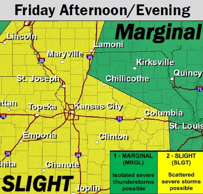
No more severe weather is expected this morning, but severe weather is possible later today, the National Weather Service said.
Another round of storms is expected to move into the area this afternoon and evening, according to the weather service. Strong to severe storms are possible with this storm.
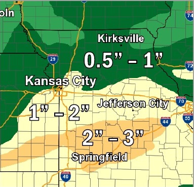
About 1 to 3 inches of rain is expected with these storms, the weather service said.
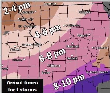
The storms are possible after 2 p.m., but are most likely to arrive in the Wyandotte County area between 4 and 6 p.m. today, according to the weather service.
The main threats from storms this afternoon and evening are isolated wind gusts up to 60 mph and isolated hail up to quarter-size, according to the weather service. The tornado threat is minimal.
Storms are expected to move out of the Kansas City area by Saturday morning, the weather service said.
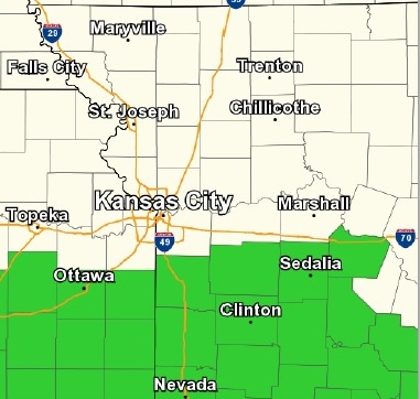
Flash flooding may become an issue south of I-70, according to the weather service.
Today’s high will be near 85, the weather service said, with a south southwest wind of 5 to 8 mph. The chance of rain and storms is 40 percent.
Tonight, the chance of precipitation is 80 percent, with showers and storms possible before midnight, the weather service said. The low will be around 58, with a west wind of 7 to 13 mph becoming north northwest in the evening. Between a quarter and half-inch of rain is possible.
Saturday, it will be sunny with a high of 74, according to the weather service. There will be a north northwest wind of 6 to 11 mph. Saturday night, it will be clear with a low of 54, the weather service said.
Sunday’s forecast is sunny with a high near 77, the weather service said.