The National Weather Service said that the storm system moving into the region has slowed down and is not expected to move into the local area until late this evening and overnight.
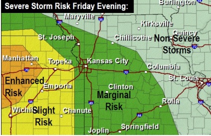
This has shifted the highest threat for strong to severe storms westward, according to the weather service.
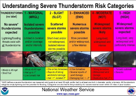
Wyandotte County is in a marginal risk area.
Weakening thunderstorms moving in from the west will spread into these areas between 6 p.m. and midnight, the weather service said. The main threats will be large hail 1 inch or greater and locally damaging winds to 60 mph. They may be scattered only.
Locally heavy rainfall and minor flooding is also possible especially north of I-70, according to the weather service.
Storms will continue to weaken when they reach these marginal risk areas between 8 p.m. and 5 a.m. There could be isolated instances of hail near 1 inch or winds of 55 to 60 mph, but the overall severe threat is low, the weather service said.
For more weather updates, visit www.weather.gov.