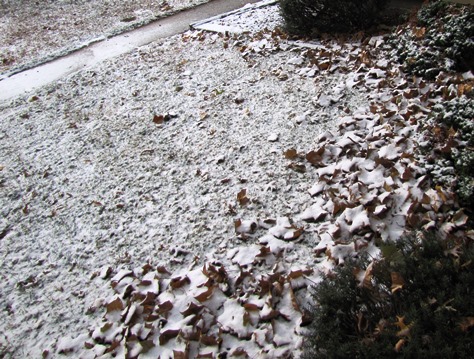
After an overnight snowfall of about a quarter-inch to a half-inch of snow in parts of Wyandotte County, the National Weather Service is warning about slippery roadways across the region this morning.
Wet roadways, combined with freezing temperatures, have led to the formation of black ice across the area in some places, the weather service said.
Temperatures will continue falling this morning as cold air filters into the region behind a cold front.
This will allow roads to become very slick in spots, especially on bridges and overpasses where road surface temperatures are typically the coldest.
Residents were advised to use extreme caution when traveling this morning, the weather service said.
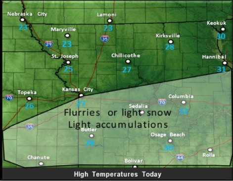
Light snow and flurries will continue to be possible this morning, mainly south of I-70, the weather service said. The area where snow will accumulate is mostly south of Kansas City.
The temperature was 19 degrees, with a wind chill of 10 degrees, at 9 a.m. Sunday morning.
Record cold is expected tomorrow into Tuesday morning.
Highs Monday will be in the upper teens to mid 20s with wind chills in the single digits.
Lows on Tuesday morning will drop into the single digits to around 10 degrees with wind chill values dropping to the single digits below 0.
To see the latest weather forecasts, visit www.weather.gov.