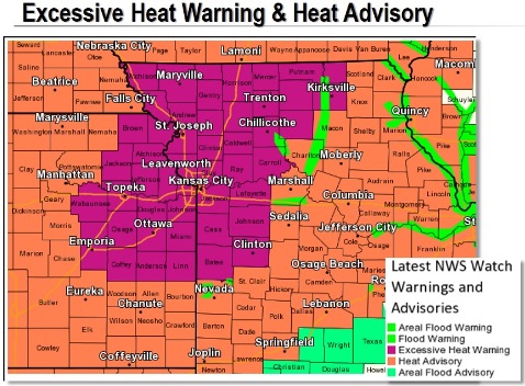
Heat advisory and warning in forecast
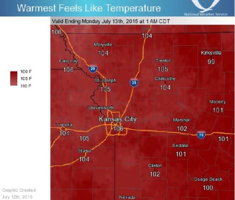
An excessive heat warning will go into effect on Monday afternoon, from noon to 9 p.m. Monday, July 13, according to the National Weather Service.
Also, a heat advisory is in effect from 11 a.m. Sunday, July 12, until noon July 13, according to the weather service.
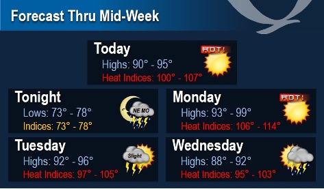
According to the weather service, temperatures today in Kansas City, Kan., could reach a high of 93, with a heat index as high as 102 degrees. There will be a south wind of 8 to 11 mph. Tonight, the low will be around 77.
Monday will be hotter. The high will be near 97, with a heat index as high as 110, the weather service said. A southwest wind will be around 9 mph.
The region could see some thunderstorm activity tonight, according to the weather service. Strong storms will be possible but bulk of severe weather threat should remain outside of this forecast area, the weather service said.
There will be a slight chance of storms in the region on Tuesday, with higher coverage and chances arriving on Wednesday.
Tuesday, the high will be near 94, and Tuesday night, the low will be around 73, the weather service said.
Wednesday, there will be a 30 percent chance of showers and storms, with a high of 91, according to the weather service. On Wednesday night, there will be a 40 percent chance of precipitation, with a low around 73.