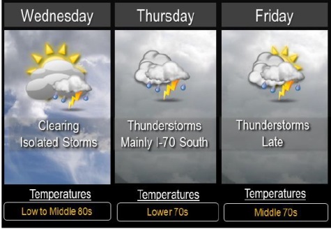
Wednesday’s weather will be clearing, mostly sunny with a high near 87, after overnight storms.
Winds on Wednesday may gust as high as 18 mph, the National Weather Service said.
Isolated storms are possible this afternoon to the south of I-70. Any storm that develops could become strong with gusty winds and hail, but most areas will remain dry, the weather service said.
Thunderstorms return to the forecast for the region from Thursday through Sunday, but not all of them will necessarily be in Wyandotte County.
Numerous thunderstorms are expected Thursday mainly from near I-70 southward.
Any severe thunderstorms are expected to stay south of a Paola to Clinton line where large hail and gusty winds are possible.
Additional thunderstorms are possible Friday and Friday night and could again be strong and produce heavy rain across much of the area.
These numerous rounds of thunderstorms could bring additional flooding to the region through the end of the week.