
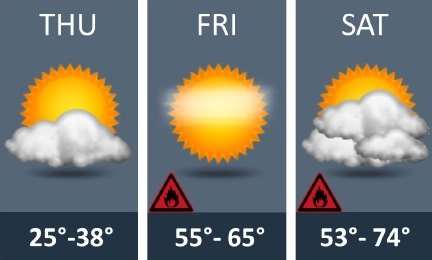
The National Weather Service predicts an almost 30-degree warm-up on Friday.
Temperatures will jump from Thursday’s high of 37 to a high near 64 on Friday.
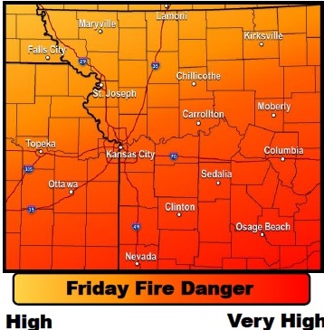
The warm and windy weather on Friday will bring with it an increased chance of fires, according to the weather service.
Winds of 15 to 25 mph will combine with relative humidity values in the 35 to 45 percent range on Friday, and outdoor burning is not encourage on either Friday or Saturday, the weather service said. Red flag conditions are not anticipated, however.
Today’s high will be near 37, with a light and variable wind becoming south southeast 5 to 8 mph in the afternoon, according to the weather service.
Tonight, expect mostly clear skies and a low of 31, with a southeast wind of 7 to 14 mph, gusting as high as 20 mph, the weather service said.
Friday, it will be sunny with a high near 64, according to the weather service. A south southwest wind of 13 to 18 mph may gust as high as 30 mph.
Friday night, the low will be around 47, with south southwest winds of 7 to 11 mph, gusting as high as 18 mph, the weather service said.
Saturday, the high will be near 69 with partly sunny skies, according to the weather service. A south wind of 6 to 8 will become west southwest in the afternoon.
Saturday night, it will be mostly cloudy, with a low of 40, the weather service said.
Sunday, the high will be near 49, with mostly cloudy skies, according to the weather service.
Sunday night, the low will be around 29, with partly cloudy skies, the weather service said.
Monday, it will be sunny with a high near 52, according to the weather service.
Monday night, the low will be around 31 with partly cloudy skies.
Tuesday, expect a high of 51 with mostly sunny skies, the weather service said.