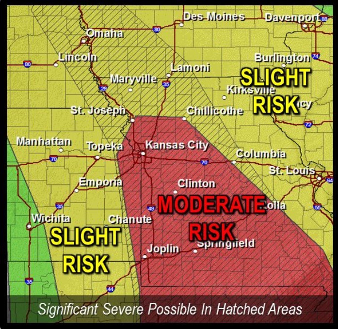
The National Weather Service has issued a tornado watch from 11:25 a.m. to 7 p.m. Sunday for Wyandotte County and the Kansas City area.
At 11 a.m., National Weather Service radar was tracking strong thunderstorms along a line extending from Lecompton to Paola, moving northeast at 75 mph.
The thunderstorm arrived in the center of Wyandotte County around 11:30 a.m.
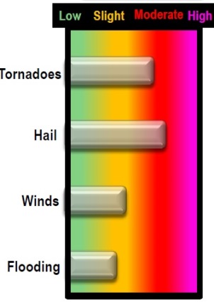
Hail up to the size of nickels and wind gusts up to 50 mph are expected with these storms, along with heavy rains.
Bonner Springs, Edwardsville and other areas of Wyandotte County were in the path of the storm.
Residents are advised to monitor local media for updated information and possible warnings from the National Weather Service.
Torrential rain may flood low-lying areas such as ditches and underpasses. Do not drive into a flooded roadway, the weather service said.