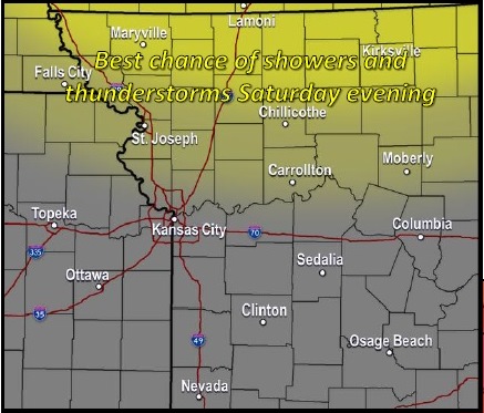
There is a slight, 20 percent chance of showers and thunderstorms today, according to the National Weather Service.
Widespread severe weather is not anticipated, the weather service said.
Today will be cool compared to next week’s weather. Today’s high will be near 86, and there will be a light east southeast wind becoming south southeast 5 to 10 mph in the morning, according to the weather service.
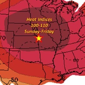
Heat index values will climb to above 100 degrees and approach 105 to 110 degrees throughout the upcoming week, according to the weather service.
Tonight, there is a 20 percent chance of showers and thunderstorms after 10 p.m., the weather service said. Forecast predictions are showing that rain is most likely north of the Kansas City area. The low will be around 75 with a south southeast wind of 8 to 10 mph.
Sunday, expect a high of 94 with mostly sunny skies, according to the weather service. There will be a south southwest wind of 9 to 16 mph with gusts as high as 23 mph.
Sunday night, the low will be around 76, with a south wind of 8 to 11 mph, the weather service said.
Monday, the high will be near 95 with mostly sunny skies, according to the weather service. There will be a south southwest wind of 6 to 8 mph.
Monday night, there is a 30 percent chance of showers and thunderstorms, the weather service said. The low will be around 75.