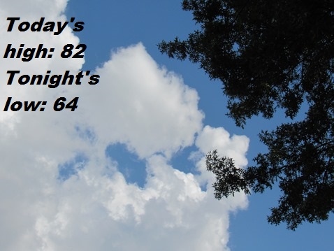
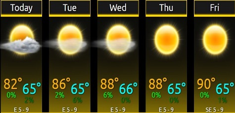
The forecast for today, Labor Day, calls for a high near 82 with cloudy skies, according to the National Weather Service.
A gradual warming trend will be seen this week, with afternoon temperatures near 90 degrees by the end of the week, the weather service said.
A patchy light fog started the day in the Kansas City area. The cloud cover was forecast to increase from east to west.
Isolated storms and showers are in the forecast for an area to the south of Kansas City this afternoon, but it was uncertain if they would affect Wyandotte County.
Today, Labor Day, it will be cloudy, then gradually becoming mostly sunny, with a high near 82 and an east northeast wind of 5 to 7 mph, the weather service said.
Tonight, it will be mostly clear, with a low of 64 and an east wind of 5 to 7 mph becoming calm after midnight, according to the weather service.
Tuesday, it will be mostly sunny, with a high near 86 and a calm wind becoming east around 5 mph in the afternoon, the weather service said.
Tuesday night, it will be mostly clear, with a low of 65 and a light southeast wind, according to the weather service.
Wednesday, it will be sunny, with a high near 88 and a calm wind becoming northeast 5 to 7 mph in the afternoon, the weather service said.
Wednesday night, it will be clear, with a low of 64, according to the weather service.
Thursday, it will be sunny, with a high near 88, the weather service said.
Thursday night, it will be clear, with a low of 63, according to the weather service.
Friday, it will be sunny, with a high near 90, the weather service said.
Friday night, it will be mostly clear, with a low of 64, according to the weather service.
Saturday, it will be sunny, with a high near 84, the weather service said.
Saturday night, it will be partly cloudy, with a low of 58, according to the weather service.
Sunday, it will be sunny, with a high near 80, the weather service said.