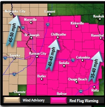
A red flag warning and a wind advisory will be in effect Wednesday in Wyandotte County.
The red flag warning will be from 10 a.m. to 7 p.m., while the wind advisory is from 11 a.m. to 7 p.m., according to the National Weather Service.
Today’s forecast calls for a 30 percent chance of showers after 5 p.m., the weather service said.
Most of the day will be mostly sunny, with a high near 59.
Tie down any loose objects outdoors today. Windy weather will see a south wind of 14 to 19 mph increasing to 23 to 28 mph in the afternoon, and winds could gust as high as 39 mph, according to the weather service forecast.
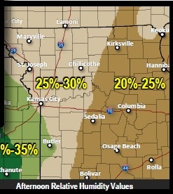
Relative humidity values today will fall to 20 to 30 percent, which will create a high fire danger, given the strong winds.
On Thursday, a cold front will move into the area, bringing a threat for thunderstorms, the weather service predicted.
Before Thursday, scattered thunderstorms will move through the area late Wednesday. Strong storms are not expected on Wednesday at this time.
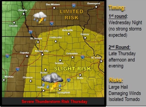
By Thursday afternoon, a line of strong to severe thunderstorms is expected to develop just west of the I-35 corridor and spread into central Missouri through the evening, the weather service said.
Depending on the degree of instability, a few of these initial storms could be super cells for a brief time near the I-35 corridor with large hail, damaging winds and isolated tornadoes.
Storms will then develop into a line moving toward central Missouri with large hail and isolated damaging winds the primary threats, the weather service said.