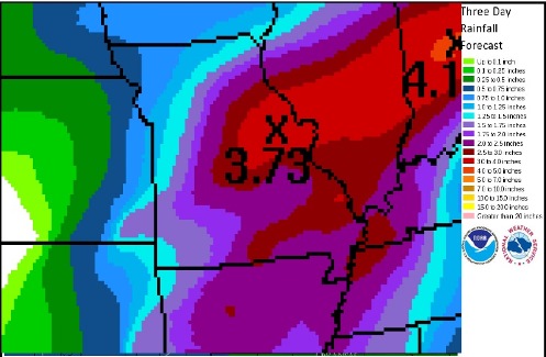
Expected precipitation amounts by Thursday evening (National Weather Service graphic)
After a morning downpour accompanied by lightning and hail in some places, residents may expect more storms and rain in the next few days.
The National Weather Service said more rain is possible. Today’s high should be 59.
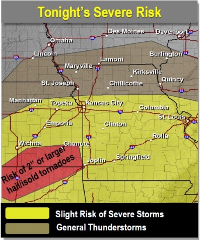
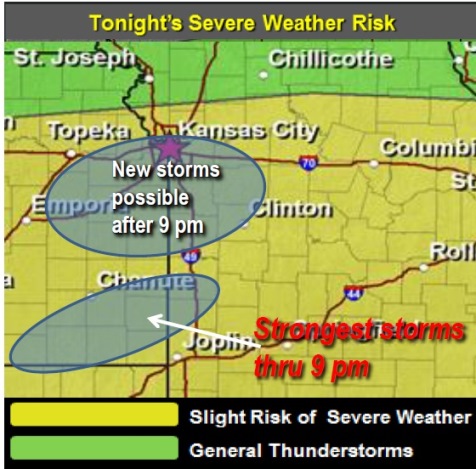
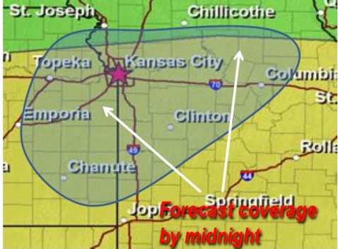
Tonight, there may be showers and thunderstorms after 1 a.m. It is a 70 percent chance of precipitation.
The weather service said there is a possibility these storms tonight could be severe, with large hail, damaging winds, flash flooding and an isolated tornado.
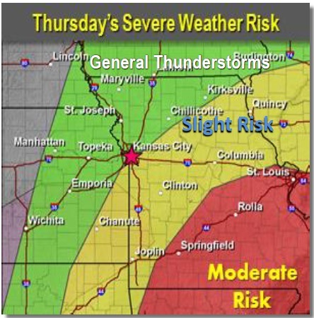
On Thursday, a 60 percent chance of thunderstorms is in the forecast, with a high of 67. There is a potential for large hail and isolated tornadoes.
The area could get from three-fourths of an inch to two inches of rain, with some areas receiving up to three inches. Widespread flooding is not expected, but flash flooding is possible.
The rain lets up for the weekend, with a forecast of windy and dry weather Friday, and sunny weather Saturday with a high of 57.
But the rain returns Sunday with a 30 percent chance of showers, the forecast stated.
There’s a 30 percent chance of rain Monday and Tuesday.
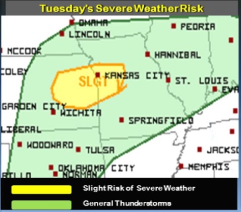
Severe weather risk Tuesday (National Weather Service graphic)
Tuesday’s weather will be partly sunny, with a high near 55 – a 20-degree drop in temperatures from Monday.
Winds will be around 6 mph, according to the National Weather Service.
Tonight, there is an 80-degree chance of showers and thunderstorms after 1 a.m.
Some of the storms could be severe, with large hail the main threat, the weather service said.
Thunderstorms continue in the Wednesday and Thursday forecasts.
Thunderstorms may redevelop Wednesday evening. The main threats for the Wednesday evening and Wednesday night thunderstorms will be large hail, damaging winds, flash flooding and perhaps an isolated tornado, the weather service said.
Wednesday’s severe weather risk (National Weather Service)