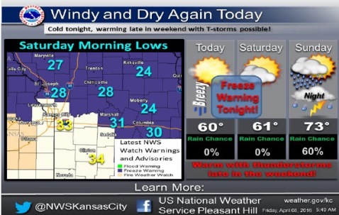
Today will be a windy and dry day, with temperatures reaching a high of 62 in Wyandotte County.
A northwest wind of 9 to 14 mph will increase to 16 to 21 mph in the afternoon, gusting as high as 30 mph, according to the National Weather Service forecast.
As humidity values once again drop into the 25 percent to 30 percent range, it will create an elevated fire danger this afternoon, the weather service said. Residents are asked to refrain from outdoor burning.
Freezing temperatures are expected Saturday morning in the region, posing a risk to sensitive vegetation, the weather service said.
In Wyandotte County, the low on Friday night is expected to be around 34, according to the weather service. A north northwest wind of 9 to 16 mph will become east after midnight, and winds could gust as high as 24 mph.
Saturday will be mostly sunny with a high near 64, the weather service said. An east wind of 9 to 16 mph will gust as high as 24 mph. Saturday night, the low will be around 54, with a south wind of 14 to 16 mph gusting to 24 mph.
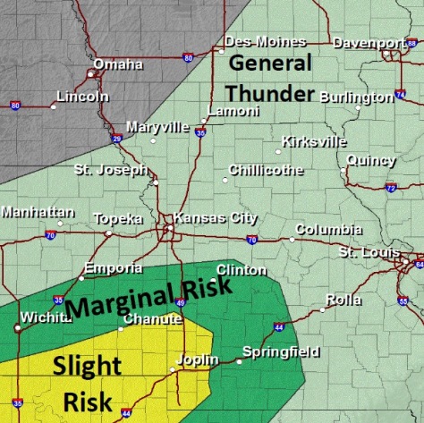
Thunderstorms are possible late in the weekend. On Sunday, there is a 40 percent chance of thunderstorms, the weather service said. Hail and strong winds are the primary hazards expected.
Sunday’s high will be near 76. Sunday night, the low will be around 48, with a 50 percent chance of rain, the weather service said.
Monday, it will be partly sunny with a high near 59, according to the weather service. Monday night, the low will be around 35.