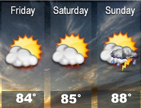
Storms are expected to stay mainly south of the region today and Saturday.
No strong storms are expected, according to the National Weather Service.
Storm chances will increase across the entire area on Sunday, the weather service said. Some storms may produce locally heavy rainfall.
Heat will return to the region Monday and last through much of the week, according to the weather service. High will be in the mid-90s with heat index values of 100 to 105.
Today, the high will be near 83, and a calm wind will become north northwest around 6 mph in the afternoon, the weather service said.
Tonight, the low will be around 67, with a north northeast wind of 3 to 7 mph, according to the weather service.
Saturday, the high will be near 85, with a calm wind becoming east around 5 mph in the afternoon, the weather service said.
Saturday night, there is a 40 percent chance of storms and thunderstorms, according to the weather service. The low will be around 70, with an east wind of 5 to 7 mph.
Sunday, the chance of storms and rain is 40 percent. It will be mostly sunny with a high near 87, and a south southeast wind o 8 mph, the weather service said.