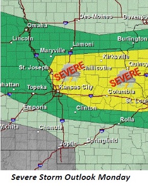
A cold front will move into the Greater Kansas City area this afternoon, according to the National Weather Service.
Thunderstorms are expected to develop by mid-afternoon along the front. The most likely time for storms will be between 3 p.m. to midnight, the weather service said.
Strong to severe weather will be possible, with damaging wind gusts and quarter sized hail the main weather hazards, according to the weather service.
Above normal temperatures will persist much of this week with heat indices between 95 degrees and 100 degrees in many areas. Heat indices may approach 105° on Wednesday, according to the weather service.
Today, the high will be 93 with mostly sunny skies, the weather service said. There will be a 20 percent chance of showers and thunderstorms after 1 p.m. Heat index values will be as high as 101. A west southwest wind of 6 to 9 mph is possible.
Tonight, there is a 30 percent chance of shower s and thunderstorms, mainly between 10 p.m. and 1 a.m., the weather service said. The low will be around 72, with a southwest wind of 3 to 5 mph. New rainfall amounts of between a tenth and a quarter of an inch are expected.
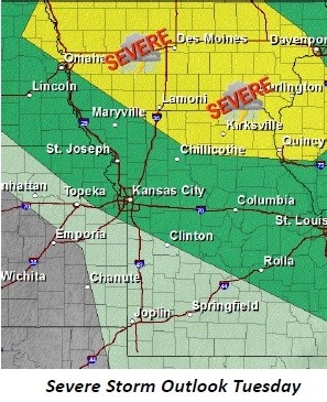
Tuesday, it will be mostly sunny with a high near 93, according to the weather service. A heat index reading of as high as 97 is possible. The south wind will be 5 to 9 mph.
Tuesday night, expect a low around 75, according to the weather service.
Wednesday’s forecast is sunny and hot, with a high near 97, according to the weather service. A south southwest wind of 9 to 16 mph gusting as high as 23 mph is possible.
Wednesday night, expect a low of 75, the weather service said.
Thursday night and Friday will be another chance of showers and thunderstorms, according to the weather service.