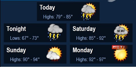
Thunderstorms will again be possible today through tonight with a slight risk of some of these storms becoming strong to severe, according to the National Weather Service.
Any moderate to heavy rainfall that falls over already saturated grounds as well as swollen rivers, creeks, and streams will exacerbate the ongoing flooding problems, the weather service said.
Heat indices will rise well into the 100s by Monday as summer heat returns, according to the weather service.
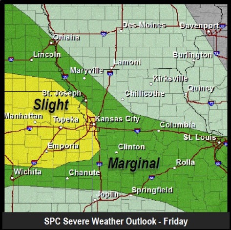
Kansas City, Kan., is on the western edge of an area that has a slight risk for severe storms today.
Primary hazards with these storms will include gusty to damaging winds, dangerous cloud-to-ground lightning, and moderate to locally heavy rainfall, according to the weather service.
A tornadic threat, as well as hail, cannot be ruled out, particularly across eastern Kansas, the weather service said.
Today, there is a risk of showers and storms, mainly after 10 a.m., the weather service said. The high will be near 82. The chance of rain is 50 percent.
Tonight, there is a 40 percent chance of showers and storms, according to the weather service. The low will be 72.
Saturday, expect mostly sunny skies with a high of 90, according to the weather service. The heat index may rise to 97 degrees. A south southwest wind of 10 to 18 may gust as high as 21 mph.
For more weather information, visit www.weather.gov/kc.