More thunderstorms are possible today in the region as a cold front drops southeast, according to the National Weather Service.
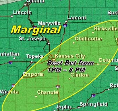
Areas southeast of a Kansas City to Kirksville, Mo., line stand the best chance of seeing storms, the weather service said.
A few storms could become marginally severe during the afternoon and early evening hours. Large hail, locally damaging winds and heavy downpours are the main threats, the weather service said.
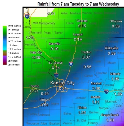
Parts of the region, especially northern Missouri, have picked up 2-5 inches of rain since Sunday night. However, additional rainfall amounts today will be considerably less with ½ to 1 inches more common, according to the weather service.
More showers and thunderstorms are expected today with the activity becoming more widespread in the afternoon hours, the weather service said.
Rainfall amounts are not expected to be as heavy as yesterday with amounts generally between one half and one inch southeast of a Kansas City to Kirksville line. That doesn’t mean a few rogue storms could still dump up to 2 inches in a few isolated spots, according to the weather service.
Today’s high will be near 83. The chance of precipitation is 70 percent, the weather service said.
Tonight, there is a 50 percent chance of showers and thunderstorms, mainly before 1 a.m., according to the weather service. The low will be about 65.
Wednesday, it will be mostly sunny with a high of 81.