Scattered thunderstorms will be possible today through late this evening in Wyandotte County, according to the National Weather Service.
Today’s high will be near 82, and winds will be around 15 mph with gusts as high as 22 mph, the weather service said. There is an 80 percent chance of precipitation.
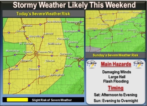
Thunderstorms may develop this morning along old outflow boundaries, with additional storms developing into the afternoon.
These storms are expected to move across the area, after 1 p.m., through the afternoon and evening hours.
The potential exists for a few strong to severe storms with wind damage the greatest threat, although widespread hazardous weather is not anticipated today, the weather service said. Locally heavy rainfall could lead to isolated areas of flash flooding later today.
Additional rounds of thunderstorms are expected Sunday evening and on Monday into Monday night, according to the weather service. The chance of rain is 10 percent Sunday in Wyandotte County. These might be strong to severe with large hail and damaging winds the primary hazards.
The heat index is expected to reach the upper 90s Sunday and Monday afternoon across the region, the weather service said.
For more information, visit www.weather.gov.