Morning showers and thunderstorms will persist through at least the late morning to early afternoon, the National Weather Service said.
Skies were dark at 9 a.m. in Wyandotte County, with increased winds, thunder, lightning and rain in some areas.
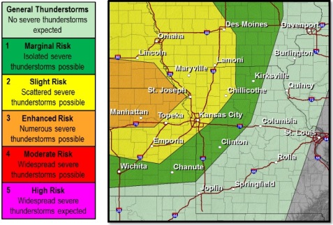
A few of these storms could be strong, but widespread severe weather is not anticipated, according to the weather service. Radar maps currently show most severe weather to the north of Wyandotte County, with a little of the storm moving through this area.
Area streams are swollen and soils are saturated, so a flood risk is present where heavy rain occurs, the weather service said.
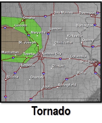
Tonight another round of storms move into the area. The highest tornado risk will be to the west of Interstate 29, but a few of the storms will likely be strong to severe as they move in, the weather service said.
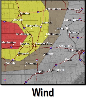
The highest risk will be for strong winds and flooding and flash flooding with any of the heavy rain that moves in.
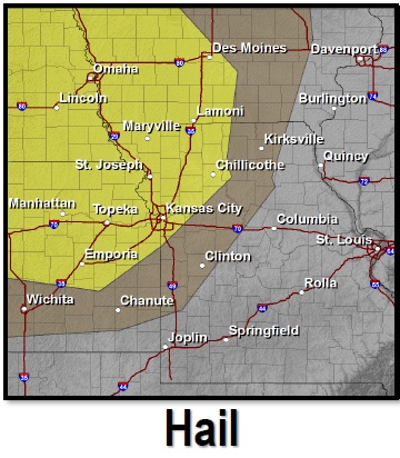
For Wednesday night, wind is the primary threat, along with heavy rain, according to the weather service. There could be some small hail, up to quarter-sized. There could also be an isolated tornado along or just west of I-29
For Thursday, there is a chance for some strong storms to form across northern Kansas, the weather service said.
These storms could move east through the evening, bringing some wind, heavy rain, and possibly some flooding, the weather service said.
Today’s showers and storms will be mainly before 4 p.m., according to the weather service. The chance of rain is 50 percent. Temperatures will reach a high of 83.
Tonight, there is a 40 percent chance of showers and storms, with a low of 67.
Rain and storms are in the forecast for Thursday through Friday evening.
More weather information is at www.weather.gov.