Storms will continue this morning to lift north, and will gradually weaken by late morning, according to the National Weather Service.
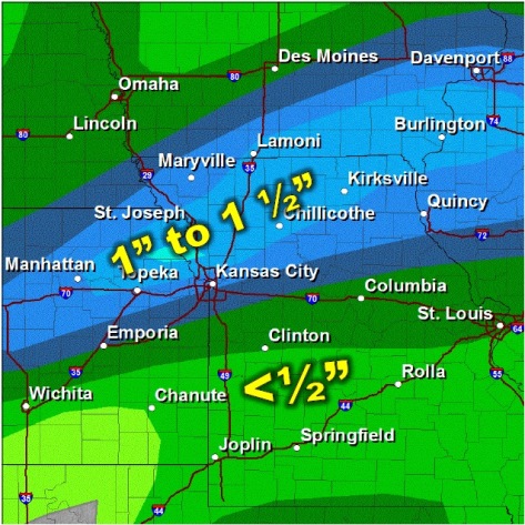
Areas of flooding are possible around the Kansas City area where heavy rain has previously fallen, the weather service said.
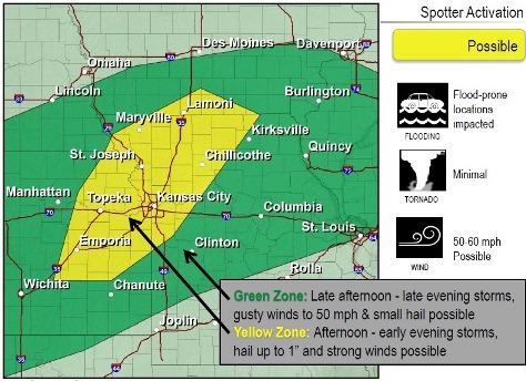
Another round of thunderstorms may develop this afternoon or evening across east central Kansas and will progressively lift northeast, according to the weather service.
The main focus for thunderstorms, and especially heavy rain, this afternoon and evening will be across much of eastern Kansas and areas north of I-44, according to the weather service, but the best potential for a few severe storms will be along the I-35 corridor.
Today, there is a 50 percent chance of showers and storms, with a high near 81, the weather service said.
Tonight, there is a 50 percent chance of showers and thunderstorms, with a low near 69, according to the weather service. Between a quarter and a half-inch of rain is possible.
Saturday, a 40 percent chance of showers and thunderstorms is in the forecast, with a high of 86. Saturday night, the low will be around 70.
Sunday, the forecast calls for a 40 percent chance of showers and thunderstorms, the weather service said, with a high near 87.
Sunday night, the low will be around 70, the weather service said.