Snow and freezing rain are in the forecast for Tuesday morning, according to the National Weather Service forecast.
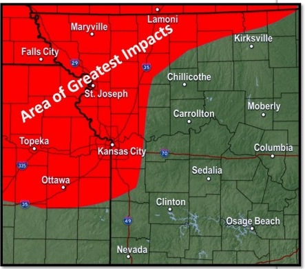
A winter weather advisory will be in effect from 6 a.m. Tuesday through 6 p.m. Tuesday in Wyandotte County, the weather service said.
Motorists are advised to slow down and use caution while traveling.
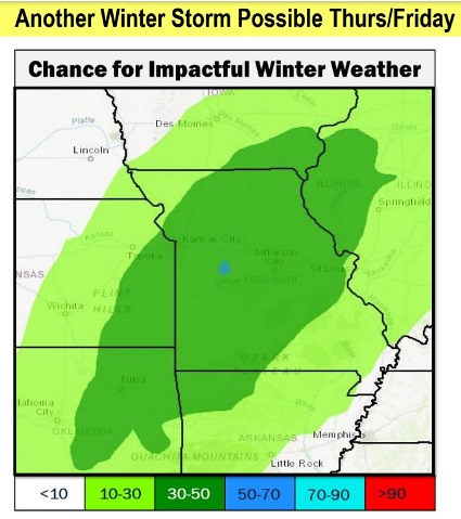
The forecast also contains a 40 percent chance of snow for Thursday night, New Year’s Eve.
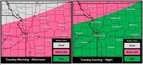
Snow and freezing rain will be possible from Tuesday morning through Tuesday afternoon, the weather service said. Snow and ice accumulations are expected, and slick roadways are possible, according to the weather service.
There will be a transition to rain and snow on Tuesday evening, with more snow possible Wednesday morning and afternoon, the weather service said. Roads could be slick.
The temperature was 29 degrees at 9 a.m. Monday, with a wind chill of 19.
Today, it will be partly sunny, with a high near 37, and a north northwest wind around 6 mph, the weather service said.
Tonight, there is a 60 percent chance of snow, mainly after 5 a.m., with a low of 28, according to the weather service. A light and variable wind will become east 5 to 10 mph in the evening. New snow accumulation will be less than a half-inch.
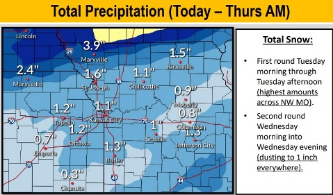
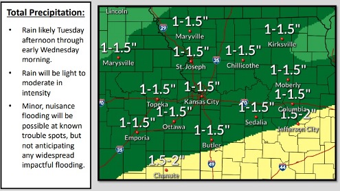
Tuesday, there is a 90 percent chance of snow, freezing rain and sleet before 1 p.m., then rain or freezing rain between 1 p.m. and 2 p.m., then rain after 2 p.m., the weather service said. The high will be near 40, with a southeast wind of 10 to 15 mph, gusting as high as 25 mph. New ice accumulation of less than a tenth of an inch is possible. New snow and sleet accumulation of less than 1 inch is possible.
Tuesday night, there is a 100 percent chance of precipitation, with rain before 4 a.m., then rain and snow likely, according to the weather service. The low will be around 31 with south southeast wind of 7 to 10 mph becoming northwest after midnight. Winds may gust as high as 20 mph. Little or no snow accumulation is expected.
Wednesday, there is a 30 percent chance of rain and snow before 7 a.m., then a chance of snow, the weather service said. The high will be near 36 with a north northwest wind of 11 mph, gusting as high as 20 mph. Less than a tenth of an inch of precipitation is possible.
Wednesday night, it will be mostly cloudy, with a low of 19, according to the weather service.
Thursday, it will be partly sunny, with a high near 33, the weather service said.
Thursday night, New Year’s Eve, there is a 40 percent chance of snow, with a low of 20, according to the weather service.
On Friday, New Year’s Day, there is a 30 percent chance of snow before noon, with a high near 32, the weather service said.
Friday night, it will be mostly cloudy, with a low of 18, according to the weather service.
Saturday, it will be mostly sunny, with a high near 38, the weather service said.
Saturday night, it will be mostly clear, with a low of 23, according to the weather service.
Sunday, it will be sunny, with a high near 45, the weather service said.
For weather updates visit www.weather.gov.