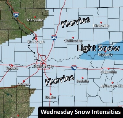
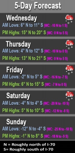
Light flurries are in the forecast for Wednesday, mainly before 4 p.m., according to the National Weather Service.
The heaviest snow is expected to be around I-70, the weather service said.
Slippery roads and sidewalks are expected, and residents are asked to exercise caution if traveling, according to the weather service. At 9 a.m., it was clear in Wyandotte County, with no snow on the highways, with a slight possibility of snow later in the day. Some of the side streets were snow-covered from a previous storm.
The prolonged stretch of sub-freezing temperatures will continue during the next several days, with bitterly cold temperatures and dangerous wind chills expected.
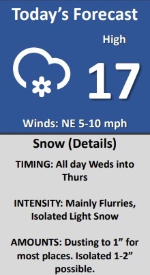
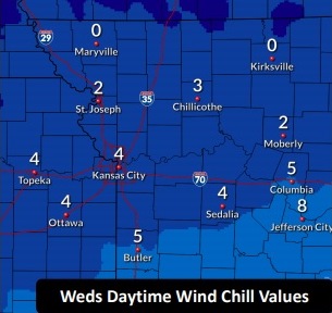
Today, there is a 30 percent chance of snow, mainly before 4 p.m., with a high near 17, the weather service said. The wind chill will be between minus 1 and 4. A north northeast wind of 8 to 10 mph is possible.
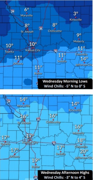
Tonight, there is a 20 percent chance of snow before midnight, then a slight chance of snow after 3 a.m., according to the weather service. The low will be around 10 with wind chill values between minus 3 and 4. A northeast wind will be around 10 mph.
Thursday, it will be cloudy, with a high near 17 and wind chill values between minus 3 and 3, and a northeast wind of 11 mph, the weather service said.
Thursday night, it will be mostly cloudy, with a low of 2 and wind chill values between minus 4 and minus 9, and a north northeast wind of 7 to 10 mph, according to the weather service.
Friday, there is a 20 percent chance of snow after noon, with a high near 12 and a north northeast wind of 8 to 11 mph, the weather service said.
Friday night, there is a 40 percent chance of snow, with a low around 0, according to the weather service.
Saturday, there is a 30 percent chance of snow before noon, with a high near 7, the weather service said.
Saturday night, it will be mostly cloudy, with a low of minus 6, according to the weather service.
Sunday, it will be partly sunny and cold, with a high near 5, the weather service said.
Sunday night, there is a 30 percent chance of snow after midnight, with a low of minus 5, according to the weather service.
Monday, Washington’s Birthday, there is a 30 percent chance of snow, with a high near 7, the weather service said.
Monday night, it will be mostly cloudy, with a low around minus 5, according to the weather service.
Tuesday, it will be partly sunny with a high near 17, the weather service said.