Overnight snowfall melted on contact with area roads and left a dusting on lawns.
As temperatures fell into the 20s froze, they created icy spots on mainly bridges, overpasses and ramps.
Residents are advised to use caution today when driving.
Temperatures were 29 degrees at 10 a.m. Sunday, with a high of 41 predicted Sunday, according to the National Weather Service.
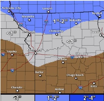
Accumulating snow is expected Monday across the region, with less than a tenth of an inch is possible in Kansas City, Kan. Snow will be heavier to the north.
Tuesday’s weather will be sunny with a high of 39. Wednesday, the high will be about 57.
There is also a chance of thunderstorms Thursday, but the threat of severe weather is low at this time. The high Thursday will be 59.
Friday, temperatures will be near 52, and Saturday, near 59.