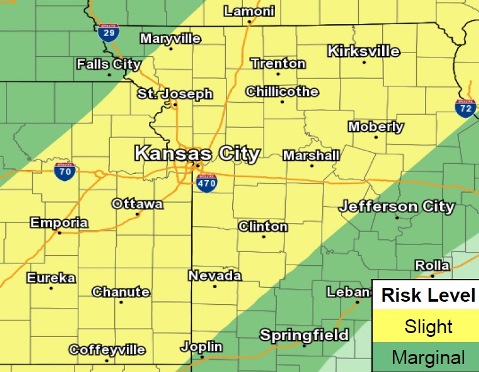
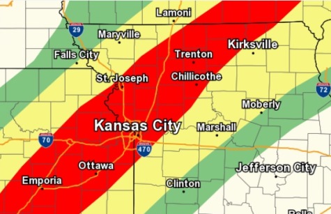
Damaging winds, large hail, heavy rain and isolated tornadoes are possible in the region this afternoon into tonight, with a chance of flash flooding, according to the National Weather Service.
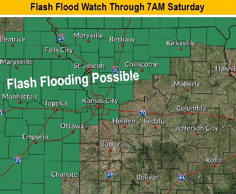
A flash flood watch is in effect for Wyandotte County from 10 a.m. Friday, May 24, through 7 a.m. Saturday, May 25, the weather service said.
The chances for flash flooding will continue tonight and overnight, and motorists should be careful to avoid flooded roads, according to the weather service.
Thunderstorms are expected to develop this afternoon along a frontal boundary that will most likely extend from north central Missouri into northeastern Kansas, the weather service said.
Several rounds of storms will be possible along this front as it is forecast to move slowly, according to the weather service. Another round of severe storms will be possible overnight.
New heavy rainfall will prolong flooding along the Missouri and lead to new flooding on its tributaries, the weather service said.
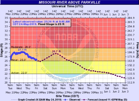
A flood warning continues for the Missouri River at Parkville until late Tuesday night, the weather service said. Minor flooding is forecast. The river was at 25.31 feet on Friday morning, where flood stage is 25 feet. The river will continue to rise to nearly 26.7 feet by early Sunday afternoon, then fall below flood stage Tuesday morning.
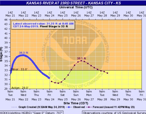
A flood warning continues for the Kansas River at 23rd Street, where the gauge is at Kansas Avenue and the state line, until late Tuesday night. Minor flooding is forecast. The river will rise above flood stage, 33 feet, by early Sunday morning and continue to rise to nearly 35.1 feet by Sunday evening, the weather service said. The river was at 31.4 feet on Friday morning. The river will fall below flood stage by Tuesday morning.
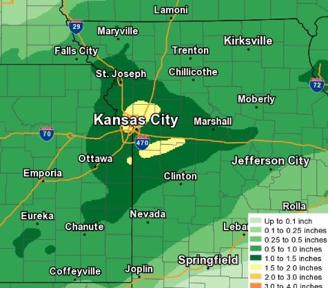
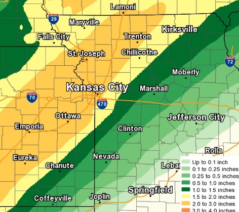
Today, the high will be near 80, with a 50 percent chance of showers and thunderstorms, mainly after 11 a.m., the weather service said. Some of the storms could produce heavy rain. A south southwest wind of 10 to 15 mph could gust as high as 26 mph. Between a quarter and half-inch of rain is possible.
Tonight, there is a 70 percent chance of showers and thunderstorms, with some of the storms producing heavy rain, according to the weather service. The low will be around 67 with a south southwest wind of 11 mph. Between 1 and 2 inches of rain are possible.
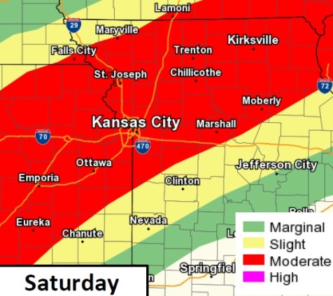
Saturday, there is a 50 percent chance of showers and thunderstorms, with a high near 81, the weather service said. A south southwest wind of 7 to 13 mph will gust as high as 24 mph. Between a quarter and half of an inch of rain is possible.
Saturday night, there is a 70 percent chance of showers and thunderstorms, mainly after 1 a.m., according to the weather service. The low will be around 65 with a south southwest wind of 6 to 9 mph. Between a quarter and half-inch of rain is possible.
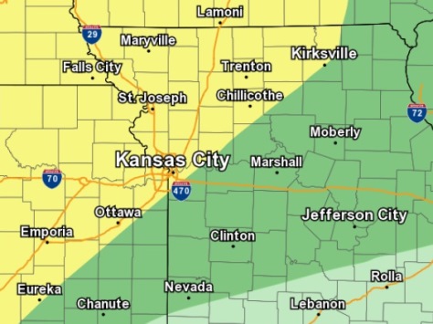
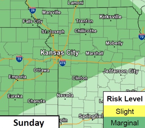
Sunday, there is a 40 percent chance of showers and thunderstorms, with a high near 80 and a south wind of 5 to 8 mph, the weather service said. New rainfall amounts of between a tenth and quarter-inch is possible.
Sunday night, there is a 30 percent chance of showers and thunderstorms, mainly after 1 a.m., according to the weather service. The low will be around 68. Between a tenth and quarter-inch of rain is possible.
Monday, Memorial Day, there will be a 50 percent chance of showers and thunderstorms before 1 p.m., the weather service said. The high will be near 83.
Monday night, it will be partly cloudy with a low of 68, according to the weather service.
Tuesday, there is a 60 percent chance of showers and thunderstorms likely after 1 p.m., the weather service said. The high will be near 82.
Tuesday night, there is a 50 percent chance of showers and thunderstorms before 1 a.m., according to the weather service. The low will be around 57.
Wednesday, it will be mostly sunny with a high near 74, the weather service said.
Wednesday night, it will be mostly clear with a low of 57, according to the weather service.
Thursday, the high will be near 76 with mostly sunny skies, the weather service said.
For more weather information, visit www.weather.gov or listen to a weather radio.