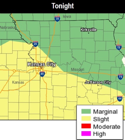
Another round of potentially severe thunderstorms will move across eastern Kansas tonight, according to the National Weather Service.
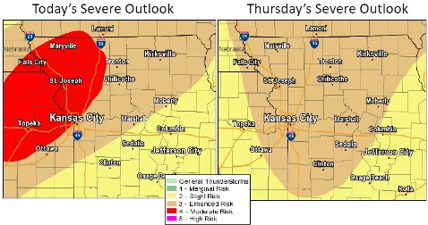
The focus for developing severe weather will be in central Kansas this afternoon, at which point they will start moving east-northeast, likely bringing the threat of severe weather to eastern Kansas and northwest Missouri by 7 p.m., according to the weather service.
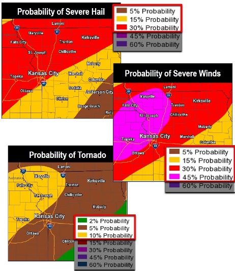
The main threats will be damaging winds, hail and flash flooding. Isolated tornadoes cannot be ruled out, the weather service said.
Storms will persist into Thursday, with severe chances dependent on tonight’s storms, but there could be a continuing severe thunderstorm chance from Thursday, mostly from hail, wind and floods, according to the weather service.
There will be a slight chance of flash flooding tonight as the storms move from eastern Kansas to Missouri, the weather service said.
The flooding threat may be from a torrential rainfall, which is expected to shift south through the overnight hours, according to the weather service.
For Wyandotte County, the weather service forecast today calls for a 30 percent chance of showers and thunderstorms, mainly after 5 p.m. The high will be near 81, with a south southwest wind of 10 to 16 mph, gusting to as high as 25 mph. Less than a tenth of an inch of rain is expected.
Tonight, there is a 70 percent chance of showers and thunderstorms, mainly between 7 p.m. and 1 a.m., according to the weather service. The low will be around 66 with a south wind of 9 to 11 mph, gusting as high as 22 mph. Between a half and three-quarters of an inch of rain is possible.
Thursday, there is a 50 percent chance of showers and thunderstorms, the weather service said. The high will be near 83 with a south wind of 11 to 17 mph, gusting as high as 32 mph. Between a tenth and quarter-inch of rain is possible.
Thursday night, there is a 40 percent chance of showers and thunderstorms, before 1 a.m., according to the weather service. The low will be around 56 with a south southwest wind of 9 to 15 mph becoming west northwest after midnight. Winds may gust as high as 26 mph.
Friday, it will be mostly sunny with a high near 77, the weather service said. A north northwest wind will be around 10 mph.
Friday night, it will be mostly clear with a low of 54, according to the weather service.
Saturday, it will be sunny with a high near 81, the weather service said.
Saturday night, the low will be around 57 with mostly clear skies, according to the weather service.
Sunday, there is a 30 percent chance of showers and thunderstorms after 1 p.m., with a high near 79, the weather service said.
For more weather information, visit www.weather.gov.