Serving Kansas City (Wyandotte County) Kansas for over 50 years!
River levels peaking, expected to decline
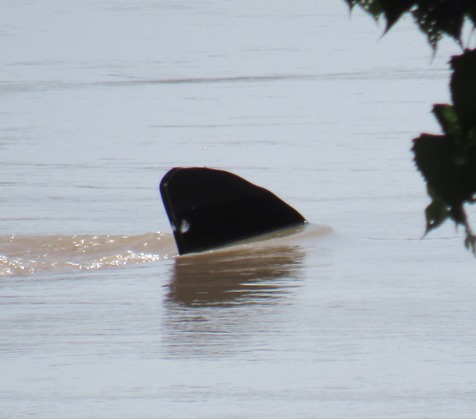
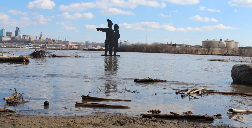
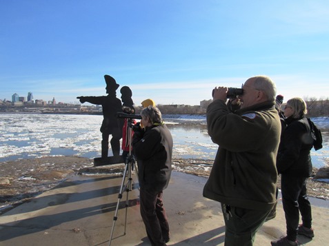
Hold onto your hat. Flood waters from the Missouri River on Saturday afternoon were up to the hat of the Lewis and Clark statue at Kaw Point Park, 1 Fairfax Blvd., Kansas City, Kansas. (Staff photo by Mary Rupert)On March 20, 2019, the river was up to the base of the Lewis and Clark statue at Kaw Point. (File photo by Steve Rupert)This is the Lewis and Clark statue on Jan. 26, 2019. (File photo by Mary Rupert)
River levels in Wyandotte County peaked and appeared to be ready to decline today, according to hydrology charts.
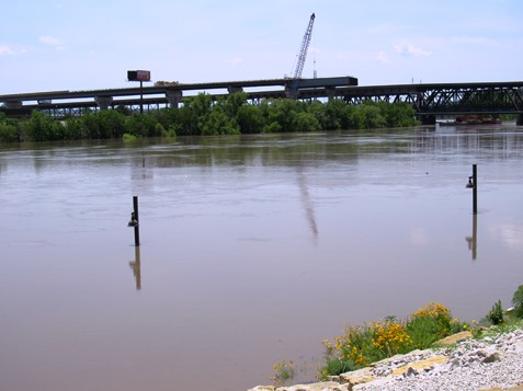
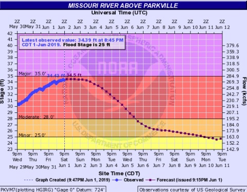
The Missouri River at Parkville, which includes the Wyandotte County area, reached a high of 34.43 feet on Saturday, and has declined very slightly since then to 34.39 feet. The river now is in moderate flood stage, and 25 feet is flood stage at that point.
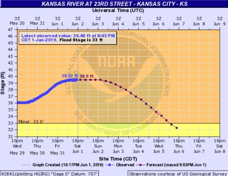
The Kansas River at 23rd Street, which is near Kansas Avenue and the state line, reached 39.52 feet today and declined slightly to 39.48 feet. It is in minor flood stage, which begins at 33 feet.
The change is very slight, and residents may check back with hydrology charts on Sunday to see if the decline holds.
At a news conference today, a meteorologist from the National Weather Service said there would be spotty thunderstorms possible during the next seven days, however, they did not seem to be significant at this time.
The next heaviest rains are now predicted for June 6-7, although that forecast is distant and subject to change, according to the weather service.
Water releases from Gavins Point Dam were increased to 75,000 cubic feet per second today, an increase of 5,000 from Friday, according to Corps officials.
In Kansas, the Corps will continue releasing 10,000 cfs from Perry Lake. Tuttle Creek near Manhattan, Kansas, is releasing 30,000 cfs.
Thirty-seven levees in the Kansas City district area have overtopped since May 22, according to Corps officials.
During today’s news conference, a member of a Missouri drainage district association asked the Corps if they could reduce Gavins Point releases by 20,000 cfs, as that would really help farmers and residents in Missouri.
Corps officials explained that if they cut releases now, they would have to increase releases later and the effect could be worse.
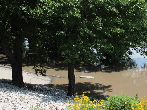
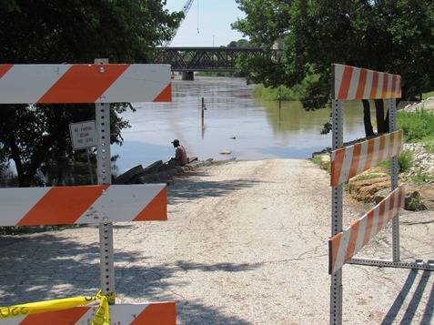
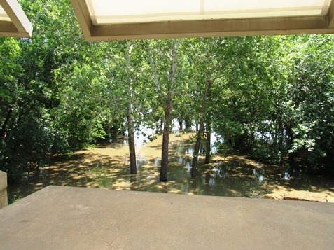
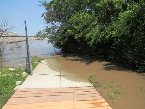
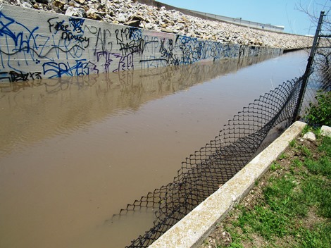
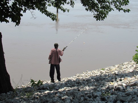
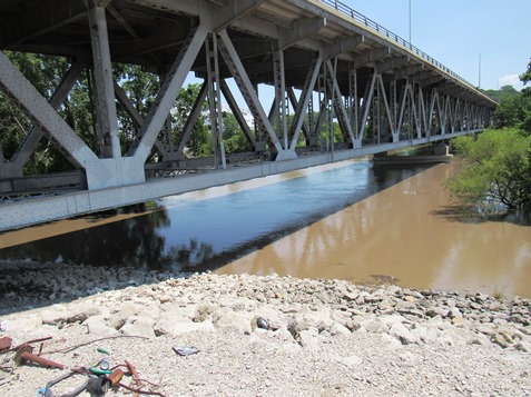
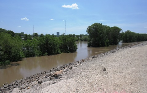
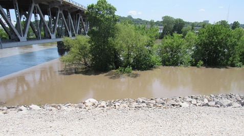
Much of the area of Kaw Point Park that was formerly walking paths is now under water from flooding of the Missouri and Kansas rivers. This photo was taken Saturday afternoon. (Staff photo by Mary Rupert)Much of the area of Kaw Point Park that was formerly walking paths is now under water from flooding of the Missouri and Kansas rivers. This photo was taken Saturday afternoon. (Staff photo by Mary Rupert)A ramp was blocked off to vehicles at Kaw Point Park Saturday because of the flood waters. (Staff photo by Mary Rupert)Much of the area of Kaw Point Park that was formerly walking paths is now under water from flooding of the Missouri and Kansas rivers. This photo, looking at the amphitheater from a viewing area above, was taken Saturday afternoon. (Staff photo by Mary Rupert)Much of the area of Kaw Point Park that was formerly walking paths is now under water from flooding of the Missouri and Kansas rivers. In the distance can be seen the river and a flood wall. This photo was taken Saturday afternoon. (Staff photo by Mary Rupert)A flood wall at Kaw Point still has several feet before flood waters from the Missouri River would overtop it. (Staff photo by Mary Rupert)A resident went fishing in all the extra water Saturday at Kaw Point Park in Kansas City, Kansas. Officials discourage people from coming into contact with flood waters. (Staff photo by Mary Rupert)The Armourdale levee at the Kansas River in Kansas City, Kansas, on Saturday. (Staff photo by Mary Rupert)The Armourdale levee at the Kansas River in Kansas City, Kansas, on Saturday. (Staff photo by Mary Rupert)The Armourdale levee at the Kansas River in Kansas City, Kansas, on Saturday. (Staff photo by Mary Rupert)The Missouri River at Parkville is expected to start declining. (National Weather Service – USGS graphic)The Kansas River at 23rd Street also is expected to start declining. (National Weather Service – USGS graphic)