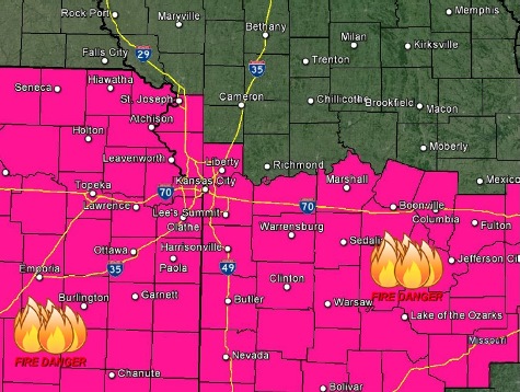
A red flag warning is in effect from noon to 7 p.m. today, according to the National Weather Service.
Residents are asked to avoid any open burning today, or any activity that could start a fire.
Also, a fire weather watch is in effect from noon to 7 p.m. on Wednesday, the weather service said.
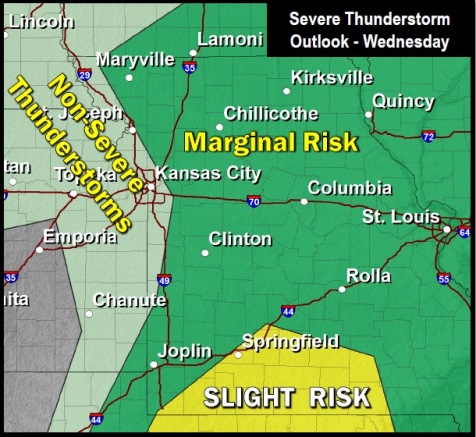
Thunderstorms are possible Wednesday afternoon and early evening, according to the weather service. A few strong to isolated severe storm are possible in the region, with a marginal risk of large hail and damaging winds.
Today’s high will be near 77, and the south southwest wind will be 16 to 24 mph, gusting as high as 33 mph, the weather service said.
Tonight, the low will be around 60, with a south southwest wind of 22 to 24 mph, gusting as high as 33 mph.
Wednesday, the high will be near 75. There is a 20 percent chance of showers and thunderstorms are 1 p.m.
Wednesday night, the low will be around 34, the weather service said, with a 30 percent chance of rain showers before 4 a.m., followed by a chance of rain and snow showers.
Thursday, the high will be near 48 with a 30 percent chance of snow showers before 7 a.m., according to the weather service. A north northwest wind of 15 to 20 mph will gust as high as 29 mph. Thursday night, the low will be around 33.
Friday, it will be mostly sunny with a high near 62, the weather service said. Friday night, the low will be around 45.
Saturday, there is a 50 percent chance of showers, according to the weather service. The high will be near 58. Saturday night, there is a 50 percent chance of rain and snow showers, and the low will be around 35.
Sunday, there is a 30 percent chance of showers with a high near 51, according to the weather service.