Scattered thunderstorms are possible in the region this afternoon, according to the National Weather Service.
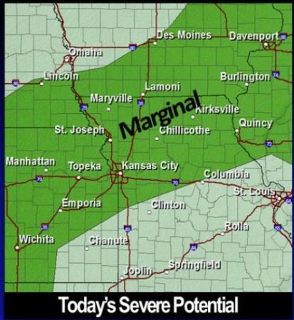
Wyandotte County is in a category of “marginal” risk, according to the weather service.
With these storms, an isolated severe storm with damaging winds and large hail is possible. Additional storms are expected area-wide tonight, and severe weather is not anticipated.
The weather service said scattered storms will be possible every day this week, while severe weather is not expected.
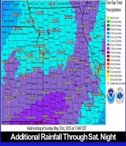
Ongoing river flooding in some places may be prolonged by additional rainfall. An additional 1 to 2.5 inches is expected through Saturday night, the weather service said.
Today the high will be near 80. There is a 20 percent chance of showers and thunderstorms before 1 p.m., then a slight chance of showers and thunderstorms after 3 p.m., the weather service said.
Tonight, the low will be around 61. There is a 40 percent chance of showers and thunderstorms, the weather service said.
Wednesday, there is a 20 percent chance of showers and thunderstorms, according to the weather service. The skies will be mostly sunny, with a high near 81.
For more weather information, see www.weather.gov.