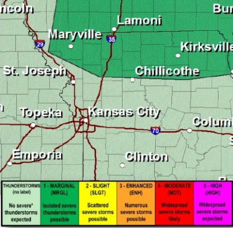
Thunderstorm chances will increase this afternoon in the northern part of the region, according to the National Weather Service, but they could miss Wyandotte County.
A few strong to marginally severe storms are possible into the evening hours, generally north of St. Joseph, Mo., the weather service said.
Large hail, damaging winds and locally heavy rains are possible north of the Greater Kansas City area, north of St. Joseph, Mo., and Atchison, Kan.
Wyandotte County still may get some rain today, although severe storms are not likely, according to the forecast. There is a 40 percent chance of showers and thunderstorms, mainly after noon, the weather service said. The high today will be near 89, with a heat index as high as 98. The wind will be south southwest from 6 to 16 mph, gusting as high as 24 mph.
Tonight, the chance of rain and storms increases to 60 percent, mainly before 4 a.m., according to the weather service. The low will be around 73, with a southwest wind of 7 to 11 mph.
On Thursday, there is a 40 percent chance of showers and thunderstorms, with a high near 84, the weather service said. A south southeast wind of 6 mph is forecast.
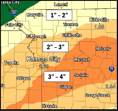
Several more rounds of storms producing heavy rain are likely Thursday night through Friday night, the weather service said.
Thursday night, the low will be around 71 with a 70 percent chance of showers and thunderstorms, according to the weather service. Between three quarters and an inch of rain is predicted.
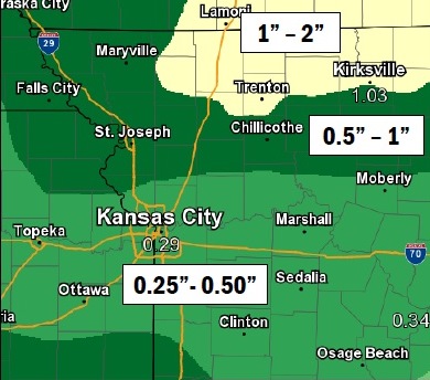
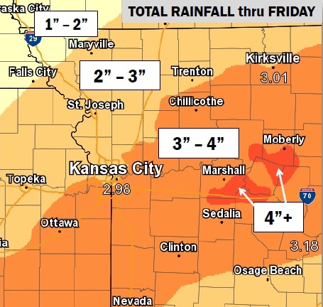
Widespread one-inch to three-inch rain amounts are likely Thursday and Friday, which could result in flooding, according to the weather service.
The chance of showers and thunderstorms is 70 percent, with a high near 83, on Friday, the weather service said. Between a half and three-quarters of an inch of rain is possible.