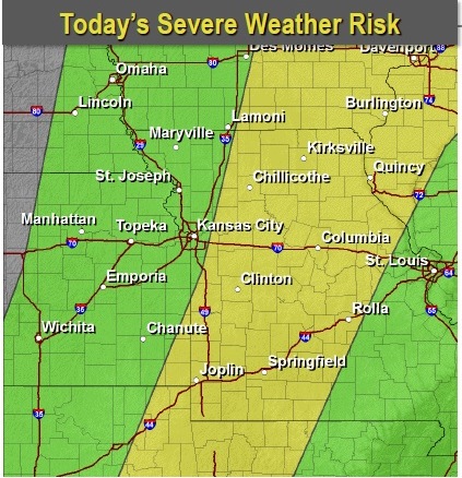
Morning thunderstorms will continue to lift northeast, clearing out of the area by mid-morning, according to the National Weather Service.
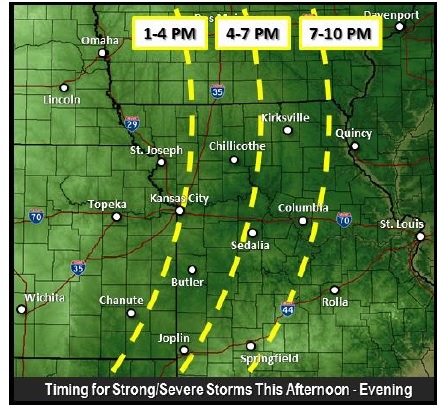
However, storms are expected to redevelop along and ahead of an eastward-moving cold front by early afternoon.
Strong straight line winds, large hail or possibly an isolated, brief tornado, are all possible with any of the more robust storms that develop, but the main threat will likely be damaging wind.
The front should be out of the Kansas City metro area by 7 p.m. and the outlook area by 10 p.m., ending any severe storm chances, the weather service said.