Cooler weather is forecast today, with a high near 40, according to the National Weather Service.
After some overnight rain, temperatures will remain cool, the weather service said. The temperature was 37 degrees at 10 a.m., with fog and mist in the area. Rain is still possible through 1 p.m., according to the weather service.
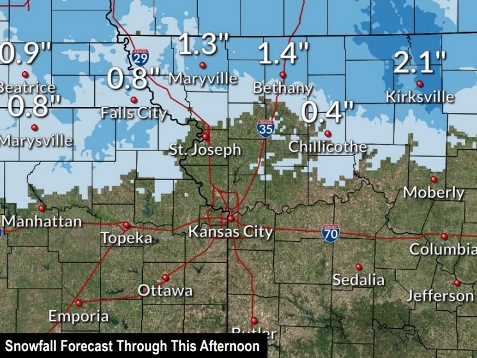
North of St. Joseph, Missouri, snow was in the forecast.
Today’s high will be near 40 with an east northeast wind of 10 to 14 mph, gusting as high as 25 mph, the weather service said. Less than a tenth of an inch of rain is possible.
Tonight, it will be cloudy, with a low of 33 and a northeast wind of 9 to 11 mph, gusting as high as 20 mph, according to the weather service.
Sunday, it will be mostly cloudy, with a high near 45 and an east wind of 7 to 9 mph, the weather service said.
Sunday night, there will be a 30 percent chance of showers after 1 a.m., and a low of 37, according to the weather service. Less than a tenth of an inch of precipitation is expected.
Monday, there is a 40 percent chance of showers, mainly before 1 p.m., the weather service said. The high will be near 55 with a light southeast wind.
Monday night, there is a 30 percent chance of showers before 1 a.m., with a low of 42, according to the weather service. Less than a tenth of an inch of rain is possible.
Tuesday, it will be cloudy with a high near 52, the weather service said.