by Mary Rupert
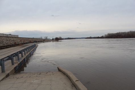
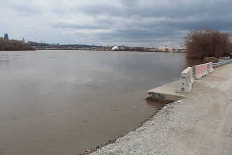
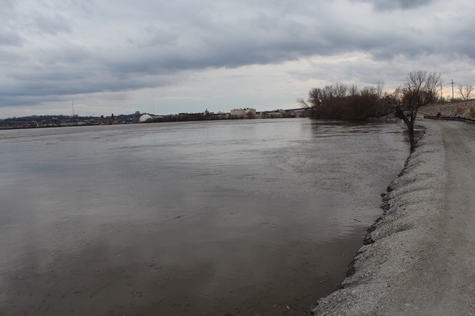
The Missouri River is expected to crest around 1 a.m. in Wyandotte County, according to Matt May, the county’s director of emergency management.
May said on Saturday evening that the 1 a.m. crest is the latest projection from the National Weather Service forecasters.
“We probably have another 6 inches in water elevation yet to go before we crest,” May said on Saturday evening.
It will stay at that elevation for about 12 hours, then it will start to recede, May said.
The river forecast is based on an assumption that water release levels upstream from the reservoirs will not change. If they do not change, the river will start to slowly decrease during the next week or two, he said. The forecast could change if for some reason higher levels of water are released from the reservoirs or if there is an unusual amount of rain along the system.
May said the forecast is “very fluid,” as it depends on different factors.
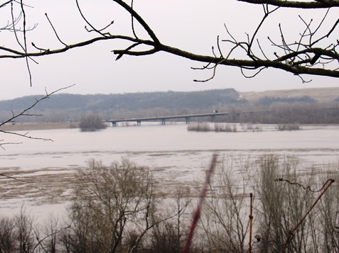
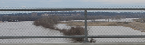
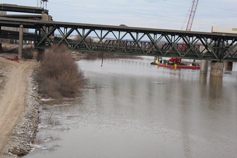
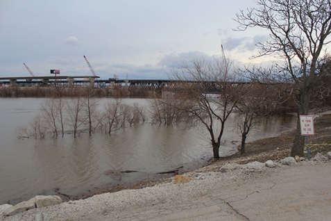
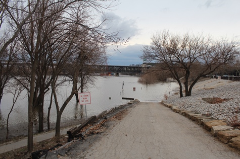
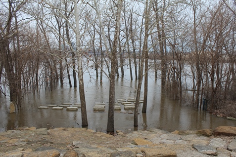
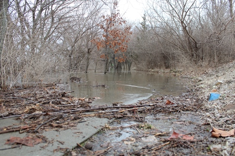
May said that as expected, there is water in low-lying areas north and east of Wolcott Drive, on both sides of I-435. There also is water by the BPU’s Nearman plant, which is located on the Missouri River near North 55th Street.
He said that was anticipated, and he said he has not heard any reports of any residential flooding. The power plant is protected by a large, tall berm, he said.
“We don’t think there’s any imminent threat to any homes that we’re aware of,” he said. It’s not a highly populated residential area.
Wolcott Drive is closed at Hutton Road to the west because of flooding. In that area, Wolcott Drive also is Highway K-5. May said he thinks that area of Wolcott will be impassable for the next 24 or 48 hours, depending on how fast the water recedes.
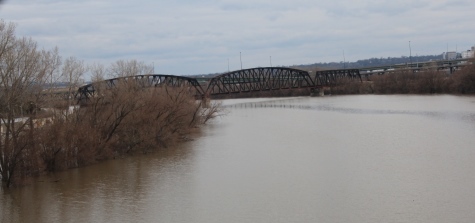
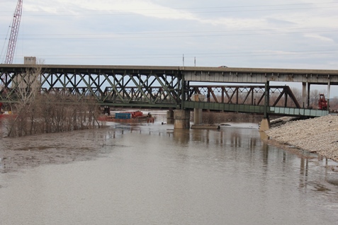
Besides a road closure on Wolcott Drive, a Union Pacific train track that runs parallel with the road is closed, with a few places under water, he said. Repairs are currently ongoing at that site, he said.
May said that any residents who have had problems in the past, such as water in their basements previously, should keep an eye on the conditions.
“If you have property susceptible to that, you probably already know it,” he said. People should be diligent, he said, but he doesn’t anticipate a lot more water.
A weather service forecast for major flooding this morning decreased to moderate flooding in mid-morning. Every time a levee breaches upstream, it drops the water level in the river here, May said. Once the water stabilizes, the level goes back up. The river levels in the forecast can’t be anticipated sometimes, and other times they can.
May is keeping his eye on water backflowing into tributaries, but added he didn’t anticipate anything happening with the creeks or tributaries, as there is only another 6 inches until the river crests.
He said the businesses along Wolcott Drive did a lot of preparation for the flooding. Sandbagging probably would not have worked, he said, because all it does is push the water in a different direction. It sometimes is good for protecting a piece of equipment or filling a gap, he added. The businesses were able to drive their trucks away to protect them, he added.
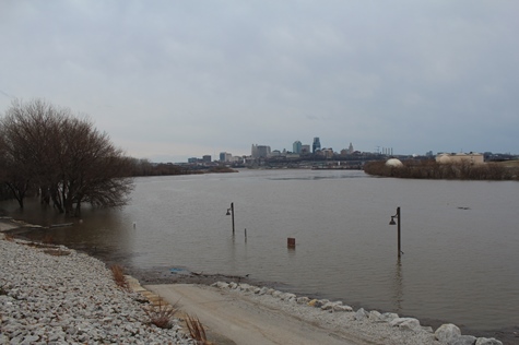
May does not believe the east side of Kansas City, Kansas, is at risk in this flood.
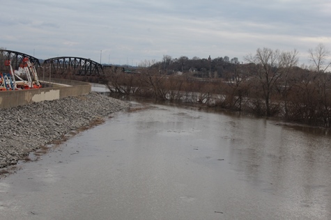
For example, on James Street the levees are much taller and the river is much wider, he said, so the area is not in danger. He said he is watching the Kansas River, which joins with the Missouri River at Kaw Point in Kansas City, Kansas, because the Missouri water could backflow into the Kansas River a little.
May and his colleagues have been taking bridge readings on the Kansas River every 12 hours, and found the water level has gone up about 3 feet during the last 48 hours, he said. He believes it will peak soon. The river is at 29.5 feet and flood stage is 41 feet, so he does not believe there will be any significant level of flooding on the Kansas River.
The Tuttle Creek reservoir near Manhattan, Kansas, has been holding back water, not releasing it, he said, so the Kansas River levels have been kept lower.
With this flood in Wyandotte County, there were no injuries, no displaced people and no shelters needed, he said.
There could be a possible need in the future to clean up any debris left behind by the flood, he added.