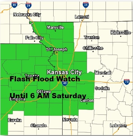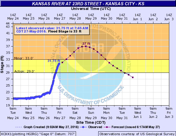
The Kansas River at 23rd Street in Kansas City, Kan., is under a flood warning until 10 p.m. Friday, according to the National Weather Service.
All of Wyandotte County is under the flood warning, along with Leavenworth County and Johnson County, as well as counties on the Missouri side of the metropolitan area.
Residents are advised not to drive through flooded roads, but to turn around and go back.
As little as 6 inches of water may cause you to lose control of your vehicle, the weather service said. Two feet of water will carry most vehicles away.
The Board of Public Utilities outage map, as of 9:40 a.m. Friday, showed about 880 customers without power in Kansas City, Kan.
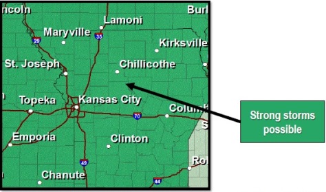
While morning hours will be quiet, it is possible that Wyandotte County could get another round or two of strong thunderstorms this afternoon, continuing through this evening, the weather service said.
The main concern of the storms will be the threat of additional river and flash flooding, according to the weather service.
A few strong or isolated severe storms are possible Saturday, while Sunday looks dry, the weather service said.
Thunderstorm chances will increase Monday through Wednesday.
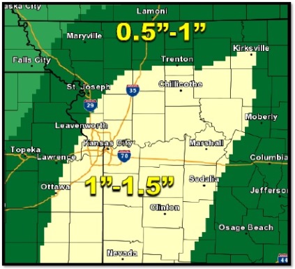
Today, the high will be near 75, with a south wind of 8 to 13 mph, the weather service said. Showers and thunderstorms are likely after 1 p.m. There is a 70 percent chance of precipitation.
Tonight, the chance of precipitation is 80 percent, with showers and thunderstorms likely before 1 a.m., the weather service said. The low will be 60 with a south wind of 9 mph.
Saturday, it will be partly sunny with a high near 78 and a south wind of 7 to 10 mph, the weather service said. There is a 30 percent chance of showers and thunderstorms.
Saturday night, expect partly cloudy skies with a low of 61, according to the weather service.
Sunday, it will be mostly sunny with a high near 83 and a west southwest wind of 5 mph becoming calm in the afternoon.
Sunday night, the forecast is mostly cloudy with a low of 63, the weather service said.
Monday, Memorial Day, there is a 40 percent chance of showers and thunderstorms with a high near 81, the weather service said.
Monday night, expect a 40 percent chance of showers and thunderstorms, with a low of 63, according to the weather service.
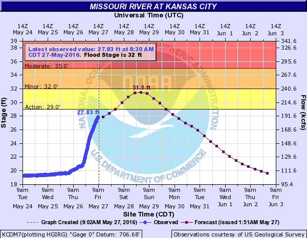
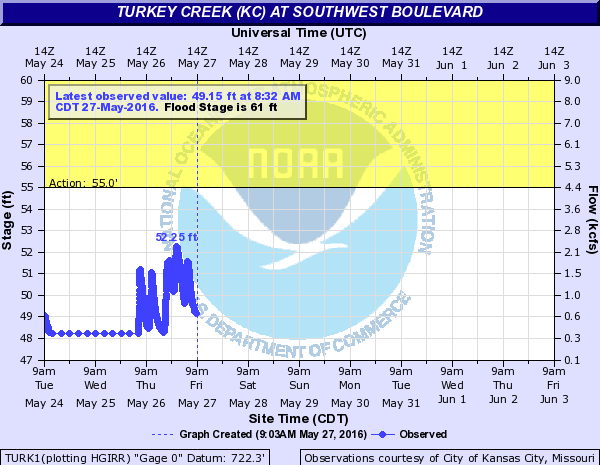
Future hydrology chart projections could change and the river level predictions could be different later.
For more information, visit www.weather.gov/kc/ or listen to a weather radio.