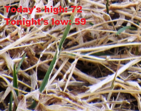
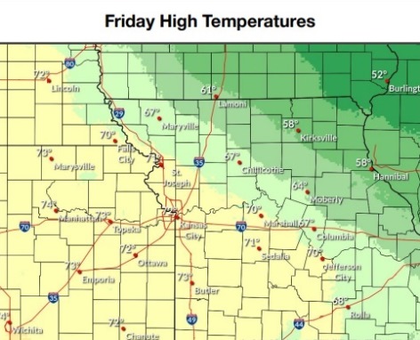
The high will reach 72 today in Wyandotte County, with an increased chance of fire weather, according to the National Weather Service forecast.
Winds up to 25 mph this afternoon will contribute to fire weather, with dry fuels also a factor. Outdoor burning is strongly discouraged on Friday, due to conditions that promote rapid fire spread, the weather service said.
A few severe storms will be possible Saturday evening, according to the weather service, with a 60 percent chance of rain in Wyandotte County.
Rain is expected to change to snow Sunday night into Monday, the weather service said.
Saturday will have a springlike feel during the day, as some moisture moves into the area from the Gulf of Mexico, according to the weather service. A cold front will move into place on Saturday evening, with the potential of strong winds and a possible isolated tornado.
It is still too early to say if the Kansas City area will see severe storms Saturday, or if storms will be east of this area, according to the forecast.
Rain is expected to change to snow on Sunday night into Monday, with light accumulations possible, the weather service said. There is still uncertainty as to whether this storm will affect the Kansas City area.
Temperatures will dip below freezing on Sunday night, Monday night and Tuesday night before returning to above freezing levels on Wednesday night.
To keep up with changing forecasts, visit www.weather.gov.
Today, it will be mostly cloudy, with a high near 72 and an east southeast wind of 9 to 16 mph becoming south in the afternoon, the weather service said. Winds may gust up to 25 mph.
Tonight, it will be cloudy, with a low of 59, according to the weather service. A south wind of 15 mph will gust as high as 22 mph.
Saturday, there is a 60 percent chance of rain, along with a possible thunderstorm after noon, the weather service said. It will gradually become sunny, and the high will be near 74. A south wind will be 16 to 24 mph, gusting as high as 37 mph. Less than a tenth of an inch of rain is possible.
Saturday night, it will be mostly clear, with a low of 34, according to the weather service. A south southwest wind of 7 to 17 mph will become north northwest after midnight, and winds may gust as high as 30 mph.
Sunday, there is a 40 percent chance of rain after noon, with a high near 50, the weather service said. A north wind of 7 to 10 mph will gust as high as 18 mph. Less than a tenth of an inch of rain is possible.
Sunday night, there is a 90 percent chance of rain before midnight, with a low of 30, according to the weather service. Between a quarter and half-inch of rain is possible.
Monday, there is a 40 percent chance of snow and freezing rain before 10 a.m., then a chance of snow between 10 a.m. and noon, the weather service said. The high will be near 36.
Monday night, it will be mostly clear, with a low of 19, according to the weather service.
Tuesday, it will be sunny, with a high near 47, the weather service said.
Tuesday night, it will be mostly clear, with a low of 27, according to the weather service.
Wednesday, it will be mostly sunny, with a high near 54, the weather service said.
Wednesday night, it will be partly cloudy, with a low of 36, according to the weather service.
Thursday, it will be mostly sunny, with a high near 51, the weather service said.