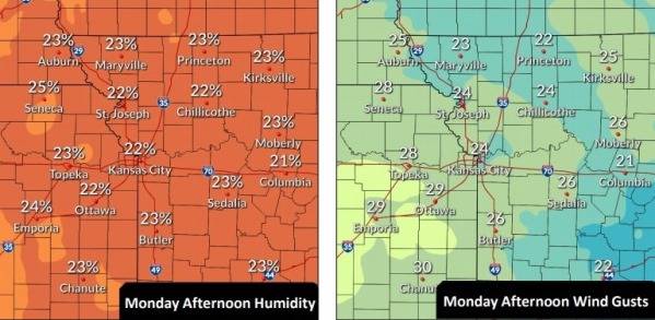
Today’s high will be near 72, with very high fire weather danger, according to the National Weather Service.
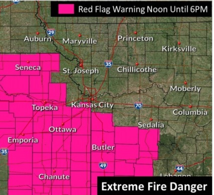
Burning should be avoided today, the weather service said. While Wyandotte County was not listed as under a red flag warning at 9 a.m. Monday, it was near some of the areas under that warning.
The Kansas Forest Service warned Kansas residents today that gusty winds and dry air, along with dry grasses and fuels, could result in a high potential for wildfires across the state.
Gov. Laura Kelly on Monday morning issued a State of Disaster Emergency in several counties because of the high risk of wildland fires, and the red flag warnings. The Kansas Highway Patrol reported on social media that it assisted in several fires, including with air support, on Sunday in the Shawnee County area.
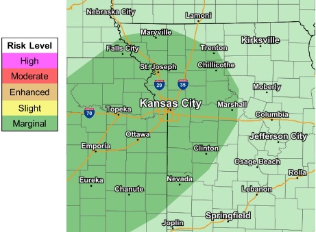
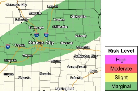
The next chance for thunderstorms will be Wednesday evening into Thursday, according to the weather service. A few strong storms are possible but widespread severe weather is not anticipated.
In some places, heavy rains could lead to flooding, the weather service said. Wyandotte County could receive marginal flash flooding, according to the weather service. Between 1 and 2 inches of rain are in the forecast for Wednesday night.
Today, it will be mostly sunny, with a high near 72 and a south southwest wind of 14 to 17 mph, gusting as high as 26 mph, the weather service said.
Tonight, it will be partly cloudy, with a low of 51 and a south wind of 11 to 15 mph, gusting as high as 20 mph, according to the weather service.
Tuesday, it will be mostly sunny, with a high near 72, the weather service said. A south wind of 14 to 21 mph will gust as high as 33 mph.
Tuesday night, the low will be around 59 with a south wind of 18 mph, gusting as high as 28 mph, according to the weather service.
Wednesday, there is a 20 percent chance of showers, with a high near 73, the weather service said. A south southwest wind of 17 to 22 mph may gust as high as 40 mph.
Wednesday night, there is an 80 percent chance of showers and a thunderstorm, according to the weather service. The low will be around 50. Between 1 and 2 inches of rain are possible.
Thursday, there is a 60 percent chance of showers, mainly before noon, with a high near 62, the weather service said.
Thursday night, it will be partly cloudy, with a low of 41, according to the weather service.
Friday, there is a 50 percent chance of showers, with a high near 52, the weather service said.
Friday night, there is a 40 percent chance of showers before midnight, then a chance of rain after midnight, according to the weather service. The low will be around 39.
Saturday, there is a 30 percent chance of rain, with a high near 51, the weather service said.
Saturday night, there is a 40 percent chance of rain, with a low of 36, according to the weather service.
Sunday, there is a 40 percent chance of rain, with a high near 50, the weather service said.