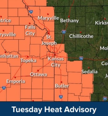
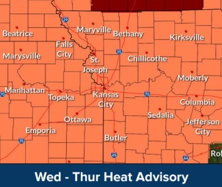
A heat advisory goes into effect at noon Tuesday, July 27, lasting through Thursday, July 29, according to the National Weather Service.
The high today will be near 95 with a heat index of 102, the weather service said.
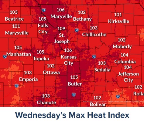
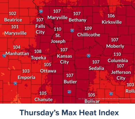
It gets hotter on Wednesday and Thursday. Wednesday, the high will be near 96 with a heat index about 105. Thursday the high will be near 97 with a heat index around 106.
Residents are advised to drink plenty of fluids, stay in an air-conditioned room, stay out of the sun, and check up on relatives and neighbors. Young children and pets should never be left unattended in vehicles under any circumstances, the weather service said.
If you work or spend time outside, take extra precautions, according to the weather service. When possible, reschedule strenuous activities to early morning or evening. Know the signs and symptoms of heat exhaustion and heat stroke. Wear lightweight and loose-fitting clothing when possible.
To reduce risk during outdoor work, the Occupational Safety and Health Administration recommends scheduling frequent rest breaks in shaded or air-conditioned environments. Anyone overcome by heat should be moved to a cool and shaded location. Heat stroke is an emergency and residents may call 911.
To see more detailed information on heat-related stress on the body, visit the Wet Bulb Globe Temperature page at https://www.weather.gov/eax/wbgt and click on Wyandotte County.
Today, it will be sunny with a high near 95 and a heat index as high as 102, the weather service said. A calm wind will become south southeast around 5 mph in the afternoon.
Tonight, it will be clear with a low of 73 and a light southeast wind, according to the weather service.
Wednesday, it will be sunny with a high near 96 and a heat index around 105, the weather service said. A calm wind will become south southwest 5 to 7 mph in the morning.
Wednesday night, it will be clear, with a low of 76, according to the weather service, and a south southwest wind of 6 mph.
Thursday, it will be sunny and hot, with a high near 97 and a west southwest wind around 6 mph, the weather service said.
Thursday night, there is a 20 percent chance of showers and thunderstorms after 1 a.m., with a low of 76, according to the weather service.
Friday, it will be partly sunny, with a high near 91, the weather service said.
Friday night, there is a 30 percent chance of showers and thunderstorms after 1 a.m., according to the weather service. The low will be around 73.
Saturday, there is a 40 percent chance of showers and thunderstorms, with a high near 87, the weather service said.
Saturday night, there is a 50 percent chance of showers and thunderstorms, with a low around 70, according to the weather service.
Sunday, it will be mostly sunny, with a high near 87, the weather service said.
Sunday night, it will be mostly clear, with a low of 66, according to the weather service.
Monday, it will be sunny, with a high near 86, the weather service said.