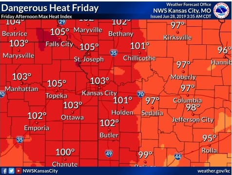
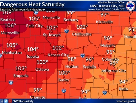
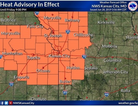
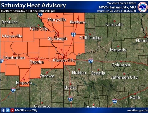
A heat advisory has been issued from 1 p.m. to 9 p.m. on Friday and 1 p.m. to 9 p.m. on Saturday in Wyandotte County.
According to the National Weather Service, afternoon temperatures today will climb into the low to middle 90s, with oppressive humidity leading to heat index values of 100 and 105.
Heat illness is possible for those spending prolonged time outside or those who are more susceptible to heat, including young children and the elderly.
Residents are advised to drink plenty of fluids, stay in an air-conditioned room, stay out of the sun and check on relatives and neighbors.
Those who spend time outside should reschedule strenuous activities to early morning or evening, if possible, the weather service said, as well as wear lightweight and loose-fitting clothing when possible. Frequent rest breaks should be scheduled in the shade or in air-conditioned rooms. Anyone overcome by heat should be moved to a cool and shaded location. In the event of heat stroke, call 911, according to the weather service.
Summer temperatures are here, and the forecast is dry through the Fourth of July, although forecasters also say that some storms are possible in the region in the latter half of next week.
Forecasters also said storms are possible to the north of Wyandotte County on Friday night after sunset, although Wyandotte County is not in the storm area at this time.
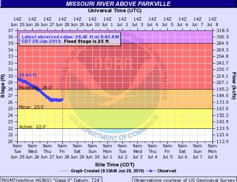
The Missouri River at Parkville, which includes Wyandotte County in its forecast area, continues in minor flood stage, according to hydrology charts.
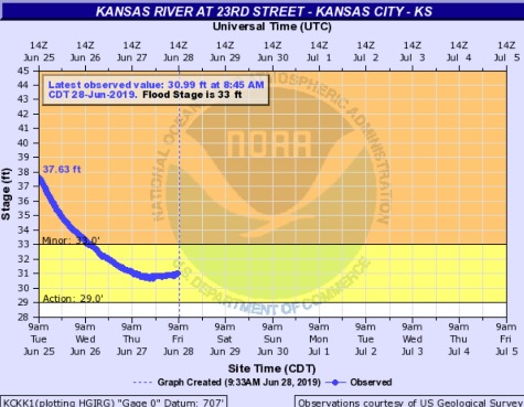
The Kansas River at 23rd Street, whose gauge is at Kansas Avenue and the state line, has dropped out of flood stage and into action stage and remains there, hydrology charts showed.
Today, it will be sunny with a high near 93 and heat index values as high as 103, the weather service said. A south southwest wind of 9 to 11 mph is forecast.
Tonight, it will be mostly clear, with a low of 72 and a south wind of 7 to 9 mph, according to the weather service.
Saturday, it will be mostly sunny, with a high near 93 and heat index values as high as 102, the weather service said. There will be a south wind of 7 to 10 mph.
Saturday night, it will be mostly clear, with a low of 73 and a calm wind, according to the weather service.
Sunday, it will be sunny with a high near 93 and a calm wind, the weather service said.
Sunday night, it will be mostly clear, with a low of 72, according to the weather service.
Monday, it will be sunny with a high near 92, the weather service said.
Monday night, it will be mostly clear, with a low of 72, according to the weather service.
Tuesday, it will be mostly sunny, with a high near 93, the weather service said.
Tuesday night, it will be partly cloudy, with a low of 73, according to the weather service.
Wednesday, it will be mostly sunny, with a high near 91, the weather service said.
Wednesday night, it will be partly cloudy with a low of 72, according to the weather service.
Thursday, Independence Day, it will be partly sunny, with a high near 89, the weather service said.
For more weather information, visit www.weather.gov.