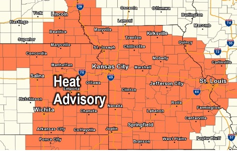
A heat advisory and air quality alert are in effect for Wednesday, according to the National Weather Service.
The heat advisory is in effect from 1 p.m. Wednesday through 8 p.m. Wednesday, and again from noon Thursday until 8 p.m. Friday, according to the weather service.
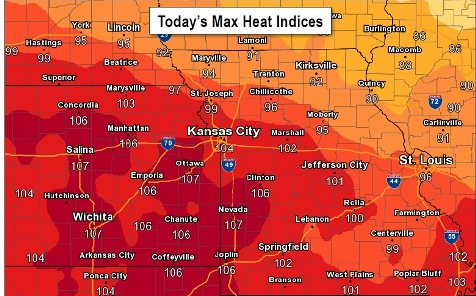
Hot and humid conditions will return today and continue through at least the end of the work week. Today’s high temperature may be 94, with a heat index reading of 103, the weather service said.
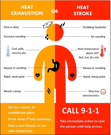
In a heat advisory, heat illnesses are possible for those spending prolonged time outdoors. Residents are advised to drink plenty of fluids, stay in an air-conditioned room, stay out of the sun and check on relatives and neighbors.
An air quality alert has been issued by the Mid-America Regional Council for Wednesday. Ozone is the primary pollutant. Under the orange ozone alert, residents and businesses are asked to avoid activities which lead to ozone formation, such as refueling vehicles, using gasoline-powered lawn equipment, idling vehicles unnecessarily. Residents are asked to car pool, bike to work, delay or combine errands and use water-based paints and cleaners. Individuals should consider limiting strenuous outdoor physical activities to reduce the risk of adverse health effects.
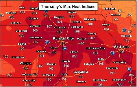
Thursday will be the warmest day with high temperatures near 100 and heat indices of 105 to 110, the weather service said. On Wednesday and Friday, highs are expected to be in the mid 90s to upper 90s with heat indices of 100 to 107.
Today, skies will be sunny with a high near 94 and a heat index as high as 103, along with a southeast wind of 3 to 7 mph, the weather service said.
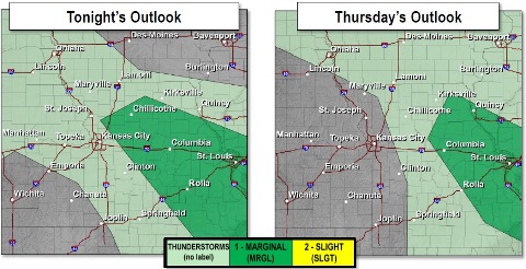
Tonight, it will be mostly clear with a low of 76, according to the weather service, and a southeast wind of 7 mph.
Thursday, it will be sunny and hot, with a high near 99, and heat index values as high as 108, the weather service said. There will be a south wind of 5 to 11 mph.
Thursday night, it will be mostly clear with a low of 78 and a south wind of 11 mph, according to the weather service.
Friday, the high will be near 97 with sunny skies, and a south southwest wind of 11 to 16 mph, gusting as high as 26 mph, the weather service said.
Friday night, it will be mostly clear with a low of 78, according to the weather service.
Saturday, it will be mostly sunny with a high near 95, the weather service said.
Saturday night, there is a 60 percent chance of showers and thunderstorms, mainly after 1 a.m., with a low of 72, according to the weather service.
Sunday, it will be partly sunny with a high near 88, the weather service said.
Sunday night, there is a 30 percent chance of showers and thunderstorms, with a low of 71, according to the weather service.
Monday, it will be partly sunny with a high near 89, the weather service said.
Monday night, the low will be around 72 with partly cloudy skies, according to the weather service.
Tuesday, it will be mostly sunny with a high near 91, the weather service said.