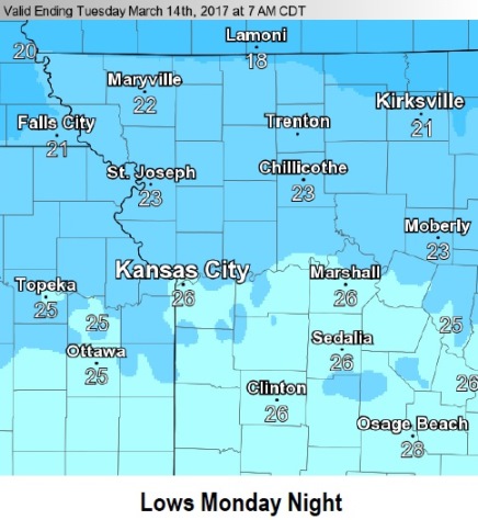
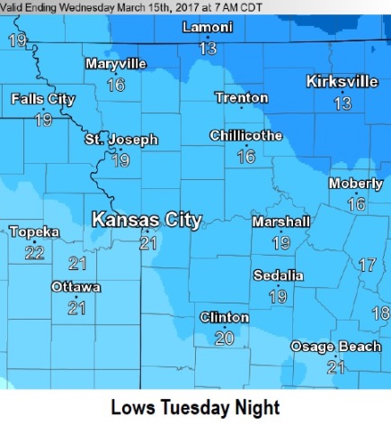
Below normal temperatures will continue through Wednesday with hard freezes expected tonight and again Tuesday night, and a chance of snow today.
A mix of light rain and snow will spread across northern Missouri today.
Areas near the Iowa border may see a light dusting of snow, otherwise no accumulation is expected.
In the forecast for Wyandotte County, there is a 30 percent chance of rain or freezing rain before noon today, then a slight chance of snow between noon and 1 p.m., according to the weather service. It will be cloudy with a high near 37, and a west wind of 7 to 17 mph becoming north in the afternoon. Winds may gust as high as 26 mph.
Tonight, the low will be around 24 with a north wind of 8 to 11 mph, according to the weather service.
Tuesday, there is a 20 percent chance of snow before 1 p.m., with a high near 37, the weather service said. There will be a northeast wind of 6 mph.
Tuesday night, it will be mostly cloudy with a low of 21, and an east wind of 5 to 7 mph, according to the weather service.
Wednesday, there will be a 20 percent chance of snow before 1 p.m., the weather service said. The high will be near 38. There will be a south southeast wind of 5 to 8 mph.
Wednesday night, it will be mostly cloudy with a low of 31, according to the weather service.
Thursday, expect partly sunny skies and a high near 58, the weather service said.
Thursday night, it will be mostly cloudy with a low of 43.
Friday, there is a 30 percent chance of showers and thunderstorms before 1 p.m., according to the weather service. The high will be near 61.
Friday night, expect partly cloudy skies and a low of 37, the weather service said.
Saturday, it will be mostly sunny, with a high near 63, according to the weather service.