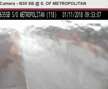
Drivers were being cautioned to watch road conditions and reduce speeds this morning with freezing rain on area highways.
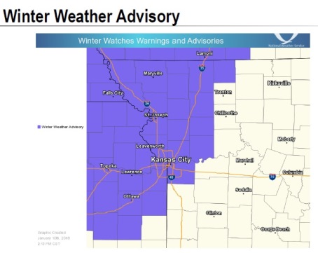
Rain, freezing rain and a wintry mix were in the forecast as the National Weather Service issued a winter weather advisory from 8 a.m. to 3 p.m. Thursday. Although at times the highways may be clear, drivers should assume that they will be slick in spots.
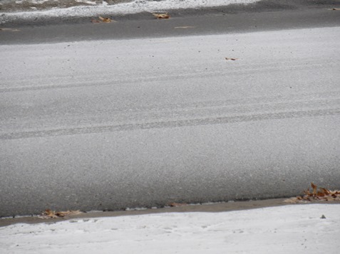
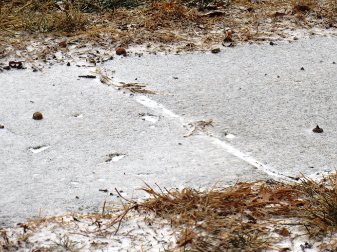
Refreezing of recent rainfall and additional light icing will result in very slippery conditions on sidewalks, roads and bridges, resulting in difficult travel conditions, according to the weather service.
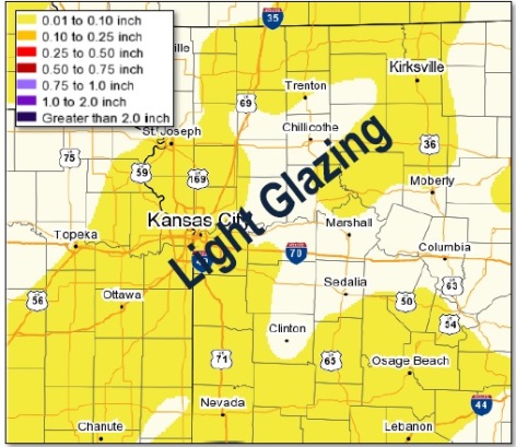
Total snow accumulations of up to one-half inch, with ice accumulations up to a light glaze, are expected, the weather service said.
The temperature was 29 degrees at 9 a.m. in Wyandotte County, and temperatures are expected to fall to around 18 degrees by 5 p.m.
The wintry mix of freezing rain, snow and possibly sleet was expected before 3 p.m. today, followed by snow between 3 p.m. and 5 p.m., the weather service said.
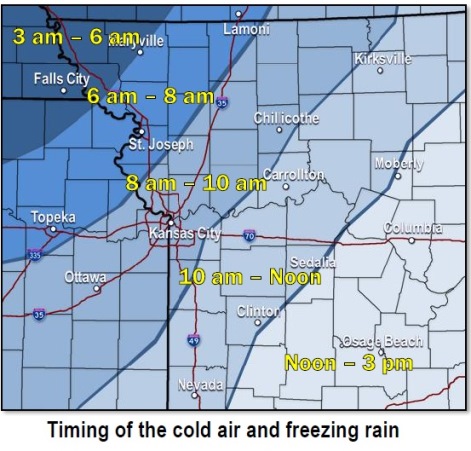
In the Kansas City area, rain will change to a wintry mix between 8 a.m. and 10 a.m., according to the weather service. Minor ice and snow accumulation is possible, the weather service said.
Because temperatures could drop rapidly, the liquid precipitation already on the ground could freeze, adding to the slick travel conditions, especially for the afternoon commute, according to the weather service.
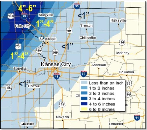
The Kansas City area is expected to get less than 1 inch of snow today, the weather service said.
Today’s forecast also includes a 20 to 23 mph north northwest wind, gusting as high as 36 mph, the weather service said.
Tonight, patchy blowing snow is expected between 8 p.m. and 10 p.m., according to the weather service. The low will be around 10, with wind chill values between minus 3 and 2. A north wind of 10 to 20 mph may gust as high as 28 mph tonight.
Friday, the high will be near 23 with increasing clouds. The wind chill will be between minus 1 and 9, with a north wind of 8 mph, according to the weather service.
Friday night, the low will be around 10, with a wind chill of between minus 1 and 4, and a north wind of 8 mph, according to the weather service.
Saturday, it will be mostly cloudy, then sunny, with a high near 19 and a north wind of 8 mph, the weather service said.
Saturday night, it will be partlyl cloudy, with a low of 8, according to the weather service.
Sunday, there is a 50 percent chance of snow before noon, with a high near 29, the weather service said.
Sunday night, there will be a 40 percent chance of snow after midnight, with a low of 16.
On Monday, Martin Luther King Jr. Day, there will be a 30 percent chance of snow before noon, with a high near 21, the weather service said.