


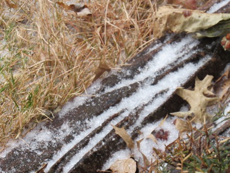
Freezing rain, sleet and snow have hit Wyandotte County and the surrounding area on Tuesday morning, leaving slick roads and accidents behind.
Icy accidents were reported at I-70 and I-635 in Wyandotte County.
The storm will make a transition to rain from 11 a.m. to 1 p.m. Tuesday, according to the National Weather Service forecast.
Wyandotte County is under a winter weather advisory now through 6 p.m. today, Dec. 29. Residents are advised to slow down and use caution while traveling. Avoid travel if possible. The latest highway conditions are available by calling 511.
There is another potential to briefly move back to a wintry mix on Wednesday, the weather service said. No additional accumulation is expected, but roads could be slick again.
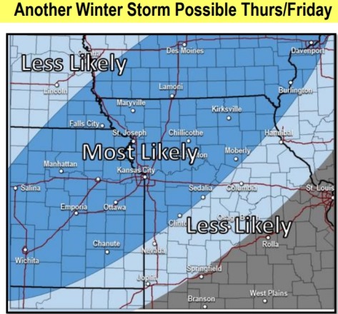
Another winter storm is possible from New Year’s Eve into New Year’s Day, the weather service said. The timing and location of the largest effects are unknown.
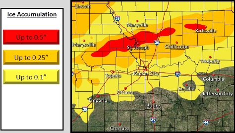
Today, there is a 100 percent chance of snow, freezing rain and sleet before noon, the weather service said. After 11 a.m., freezing rain is possible between 11 a.m. and 2 p.m., then rain after 2 p.m., according to the forecast. The high will be near 45 with an east southeast wind of 8 to 16 mph, gusting as high as 29 mph. Total daytime ice accumulation is less than a tenth of an inch. Total daytime snow and sleet accumulation of 1 to 2 inches is possible.
Tonight, there will be a 100 percent chance of rain before 4 a.m., then a chance of rain and snow between 4 a.m. and 5 a.m., then a slight chance of snow after 5 a.m., according to the weather service. The low will be around 31 with a south southeast wind of 5 to 14 mph becoming northwest after midnight. Winds may gust as high as 18 mph. Little or no snow accumulation is expected.
Wednesday, it will be mostly cloudy, with a high near 37 and a north northwest wind of 8 to 13 mph, gusting as high as 18 mph, the weather service said.
Wednesday night, it will be partly cloudy, with a low of 20 and a north northwest wind of 6 mph becoming light and variable, according to the weather service.
Thursday, it will be partly sunny, with a high near 36 and an east northeast wind of 5 to 9 mph, the weather service said.
Thursday night, New Year’s Eve, there is a 90 percent chance of rain, snow, freezing rain and sleet before 9 p.m., then a chance of snow, freezing rain and sleet between 9 p.m. and midnight, followed by snow and freezing rain after midnight, according to the weather service. The low will be around 25. Between three-quarters and one inch of precipitation is possible.
On Friday, New Year’s Day, there is a 90 percent chance of snow and freezing rain, becoming all snow after 9 a.m., the weather service said. The high will be near 33.
Friday night, it will be mostly cloudy, with a low of 18, according to the weather service.
Saturday, it will be mostly sunny, with a high near 34, the weather service said.
Saturday night, it will be partly cloudy, with a low of 20, according to the weather service.
Sunday, it will be mostly sunny, with a high near 43, the weather service said.
Sunday night, it will be partly cloudy, with a low of 28, according to the weather service.
Monday, it will be partly sunny, with a high near 44, the weather service said.