
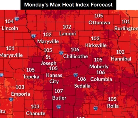
The heat index could reach as high as 105 today, the Fourth of July, in Wyandotte County.
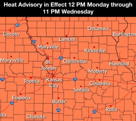
A heat advisory will be in effect from noon July 4 until 11 p.m. July 6, according to the National Weather Service.
Today’s high could reach near 96 wth a south southwest wind of 11 to 14 mph, gusting to 20 mph, the weather service said.
Tonight’s low will be around 78 with a south wind of 8 to 11 mph, according to the weather service.
Look for another hot day on Tuesday, when the high will be near 98 with a heat index as high as 105, the weather service said. A south southwest wind of 8 to 13 mph will gust up to 21 mph.
Wednesday will bring a slight chance of showers nad thunderstorms before 1 p.m., with a high near 97, the weather service said.
Storms and showers also are possible Wednesday night, mainly after 1 a.m., when the low will be around 77, according to the weather service.
Rain chances will increase Thursday and Friday, the weather service said. Thursday night and Friday will have a 30 percent chance of rain.
Temperatures will decline to the low 90s this weekend, the weather service said.