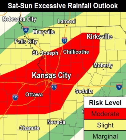
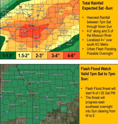
The forecast from the National Weather Service has changed a little to increase the amount of rain possible over the weekend to four inches.
Wyandotte County will be under a flash flood watch from 7 p.m. Saturday, Sept. 21, until 7 p.m. Sunday, Sept. 22, the weather service said.
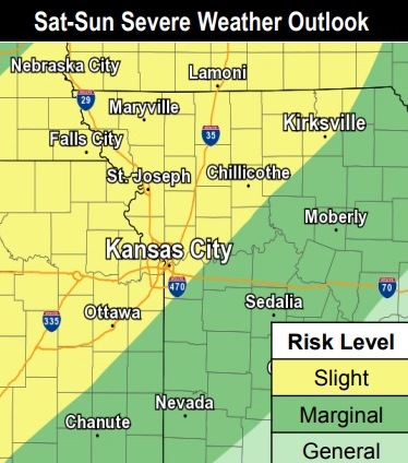
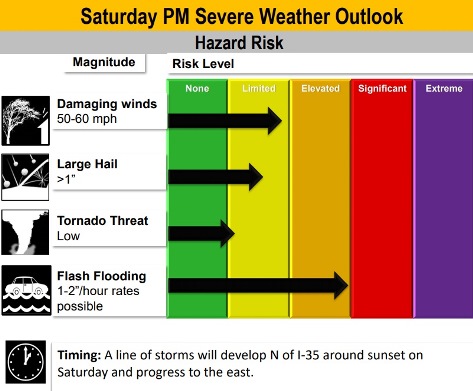
Severe weather is possible Saturday night into the overnight hours, according to the weather service. The main threats are damaging winds and large hail Saturday night.
Widespread moderate to heavy rain is possible Saturday night through Sunday night, the weather service said.
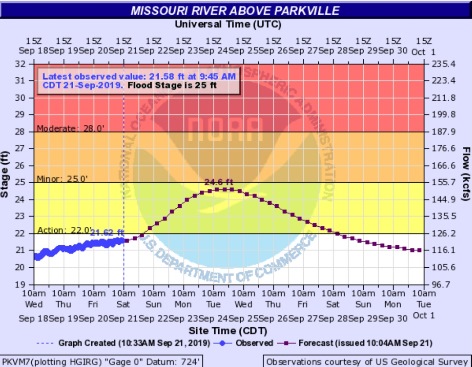
Missouri River flooding may increase with these storms. The Missouri River at Parkville, which includes the Wyandotte County area, is currently below action stage and is projected to rise to action stage on Sunday. The Missouri River at Atchison, Kansas, is currently in action stage and is projected to rise to minor flood stage on Saturday or Sunday. The Missouri River at St. Joseph, Missouri, is currently in minor flood stage and is projected to rise to moderate flood stage on Sunday or Monday.
Residents are asked to avoid driving through flood water in the roads, to turn around and find another route.
Today, there is a 60 percent chance of showers and thunderstorms in the forecast mainly before noon, with a high today near 79. A south wind of 15 to 17 mph will gust as high as 26 mph. Between a tenth and quarter-inch of rain is possible.
Tonight, there is a 100 percent chance of showers and thunderstorms, some of which can produce heavy rain. The low will be around 69 with a south wind of 9 to 16 mph, gusting as high as 24 mph. Between 2 and 3 inches of rain are possible.
Sunday, there is a 90 percent chance of showers and thunderstorms, mainly before 1 p.m., the weather service said. The high will be near 74 with a south wind of 8 to 13 mph becoming northwest in the afternoon. Between 1 and 2 inches of rain are possible.
Sunday night, there is a 20 percent chance of showers and thunderstorms before 1 a.m., with a low of 56, according to the weather service. The low will be around 56 with a north northwest wind of 5 to 8 mph becoming calm in the evening.
For more weather information, visit www.weather.gov.